Kamaroúla geodata
Kamaroúla (West Greece) is a populated place; located in Greece in Europe/Athens (GMT+3) time zone. With population of 595 people, there are 1593 cities with bigger population in this country. Compared to other cities in Greece, 59.3% of cities are located further ↑North; 83.9% of cities are located further →East and 69.1% of cities have lower elevation than Kamaroúla. Note1
Administrative division(s):
- Level 1: West Greece
- Level 2: Nomós Aitolías kai Akarnanías
- Level 3: Dimos Agrinio


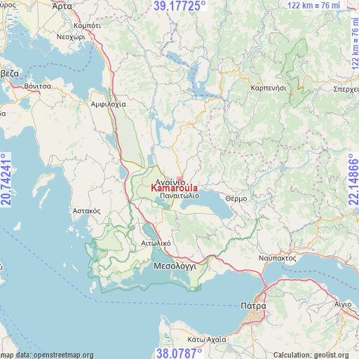
Kamaroúla GPS coordinates[2]
38° 37' 48.288" North, 21° 26' 43.908" East
| Map corner | latitude | longitude |
|---|---|---|
| Upper-left | 39.17725°, | 20.74241° |
| Center: | 38.63008°, | 21.44553° |
| Lower-right: | 38.0787°, | 22.14866° |
| Map W x H: | 122.1×122.1 km | = 75.9×75.9mi |
| max Lat: | 41.72048° ⇑59.3% North |
| Kamaroúla: | 38.63008° |
| min Lat: | ⇓40.7% South 34.8346° |
| min Long | Kamaroúla | max Long |
| 19.40494° | 21.44553° | 29.59361° |
| W 16.1%⇐ | ⇒83.9% E |
Elevation
Elevation of Kamaroúla is 158 m = 518 ft, and this is 10.9 m = 36 ft below average elevation for this country.
| Max E: |
1439 m = 4721 ft | 30.9% |
| Avg. | 168.9 m = 554 ft | |
| Kamaroúla | 158 m = 518 ft | |
Min E: |
0 m = 0 ft | 69.1% |
See also: Greece elevation on elevation.city.
Geographical zone
Kamaroúla is located in North temperate zone (between Tropic of Cancer and the Arctic Circle). Distance of this Northern Tropic circle is 1689.3 km =1049.7 mi to South.| Distance of | km | miles | from Kamaroúla |
|---|---|---|---|
| North Pole | 5711.8 | 3549.1 | to North |
| Arctic Circle | 3105.9 | 1929.9 | to North |
| Tropic Cancer | 1689.3 | 1049.7 | to South |
| Equator | 4295.3 | 2669 | to South |


Nearby cities:
15 places around Kamaroúla: (largest is in red/bold)
• Agrínio
3.4 km =2.1 mi,  253°
253°
• Dhokímion
5.9 km =3.7 mi, 251°
• Kainoúryion
4.6 km =2.9 mi,  127°
127°
• Megáli Khóra
6.5 km =4 mi,  285°
285°
• Neápolis
8.5 km =5.3 mi,  302°
302°
• Néa Avórani
2.4 km =1.5 mi,  175°
175°
• Panaitólion
5.2 km =3.2 mi, 178°
• Pandánassa
10.1 km =6.3 mi,  108°
108°
• Pappadhátai
11.3 km =7 mi, 177°
• Paravóla
6.7 km =4.2 mi,  104°
104°
• Spoláïta
11.4 km =7.1 mi,  311°
311°
• Strátos
12 km =7.5 mi, 290°
• Triandaíika
6.1 km =3.8 mi, 297°
• Zevgarákion
10.7 km =6.6 mi,  194°
194°
• Áyios Konstandínos
4 km =2.5 mi,  275°
275°
Sources, notices
• [Note1] Compared only with cities in Greece existing in our database
• [Src1] Map data: © OpenStreetMap contributors (CC-BY-SA)
• [Src2] Other city data from geonames.org with taken over terms of usage.
• [Src3] Geographical zone / Annual Mean Temperature by Robert A. Rohde @ Wikipedia
