Neochóri geodata
Neochóri (North Aegean) is a populated place; located in Greece in Europe/Athens (GMT+3) time zone. With population of 561 people, there are 1674 cities with bigger population in this country. Compared to other cities in Greece, 65.7% of cities are located further ↑North; 93.9% of cities are located further ←West and 51.8% of cities have lower elevation than Neochóri. Note1


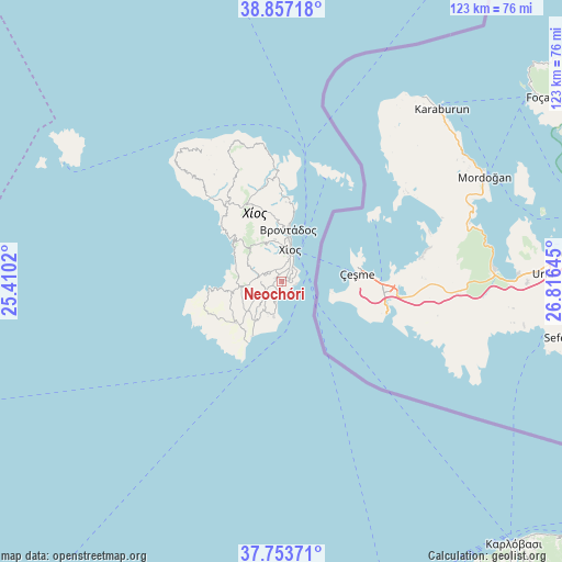
Neochóri GPS coordinates[2]
38° 18' 27.144" North, 26° 6' 47.952" East
| Map corner | latitude | longitude |
|---|---|---|
| Upper-left | 38.85718°, | 25.4102° |
| Center: | 38.30754°, | 26.11332° |
| Lower-right: | 37.75371°, | 26.81645° |
| Map W x H: | 122.7×122.7 km | = 76.2×76.2mi |
| max Lat: | 41.72048° ⇑65.7% North |
| Neochóri: | 38.30754° |
| min Lat: | ⇓34.3% South 34.8346° |
| min Long | Neochóri | max Long |
| 19.40494° | 26.11332° | 29.59361° |
| W 93.9%⇐ | ⇒6.1% E |
Elevation
Elevation of Neochóri is 88 m = 289 ft, and this is 80.9 m = 265 ft below average elevation for this country.
| Max E: |
1439 m = 4721 ft | 48.2% |
| Avg. | 168.9 m = 554 ft | |
| Neochóri | 88 m = 289 ft | |
Min E: |
0 m = 0 ft | 51.8% |
See also: Greece elevation on elevation.city.
Geographical zone
Neochóri is located in North temperate zone (between Tropic of Cancer and the Arctic Circle). Distance of this Northern Tropic circle is 1653.5 km =1027.4 mi to South.| Distance of | km | miles | from Neochóri |
|---|---|---|---|
| North Pole | 5747.7 | 3571.5 | to North |
| Arctic Circle | 3141.8 | 1952.2 | to North |
| Tropic Cancer | 1653.5 | 1027.4 | to South |
| Equator | 4259.4 | 2646.7 | to South |


Nearby cities:
15 places around Neochóri: (largest is in red/bold)
• Chalkeió
3.1 km =1.9 mi,  335°
335°
• Chios
7.1 km =4.4 mi,  17°
17°
• Kalamotí
10.1 km =6.3 mi,  216°
216°
• Kallimasiá
1.8 km =1.1 mi,  212°
212°
• Kardámyla
24.6 km =15.3 mi,  355°
355°
• Karyés
9.4 km =5.8 mi,  351°
351°
• Lagkáda
19 km =11.8 mi,  2°
2°
• Nénita
7.8 km =4.8 mi,  192°
192°
• Oinoússes
24.9 km =15.5 mi, 22°
• Pyrgíon
13.4 km =8.3 mi,  227°
227°
• Sykiáda
17.4 km =10.8 mi, 3°
• Tholopotámi
3.8 km =2.4 mi,  248°
248°
• Thymianá
1.8 km =1.1 mi,  65°
65°
• Vrontádos
11.3 km =7 mi,  7°
7°
• Ágios Geórgios Sykoúsis
5.1 km =3.2 mi,  284°
284°
Sources, notices
• [Note1] Compared only with cities in Greece existing in our database
• [Src1] Map data: © OpenStreetMap contributors (CC-BY-SA)
• [Src2] Other city data from geonames.org with taken over terms of usage.
• [Src3] Geographical zone / Annual Mean Temperature by Robert A. Rohde @ Wikipedia
