Nénita geodata
Nénita (North Aegean) is a populated place; located in Greece in Europe/Athens (GMT+3) time zone. With population of 903 people, there are 1127 cities with bigger population in this country. Compared to other cities in Greece, 67.1% of cities are located further ↑North; 93.6% of cities are located further ←West and 66.7% of cities have lower elevation than Nénita. Note1


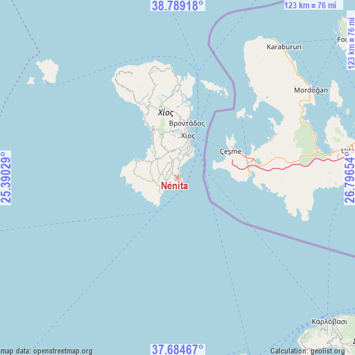
Nénita GPS coordinates[2]
38° 14' 20.472" North, 26° 5' 36.276" East
| Map corner | latitude | longitude |
|---|---|---|
| Upper-left | 38.78918°, | 25.39029° |
| Center: | 38.23902°, | 26.09341° |
| Lower-right: | 37.68467°, | 26.79654° |
| Map W x H: | 122.8×122.8 km | = 76.3×76.3mi |
| max Lat: | 41.72048° ⇑67.1% North |
| Nénita: | 38.23902° |
| min Lat: | ⇓32.9% South 34.8346° |
| min Long | Nénita | max Long |
| 19.40494° | 26.09341° | 29.59361° |
| W 93.6%⇐ | ⇒6.4% E |
Elevation
Elevation of Nénita is 146 m = 479 ft, and this is 22.9 m = 75 ft below average elevation for this country.
| Max E: |
1439 m = 4721 ft | 33.3% |
| Avg. | 168.9 m = 554 ft | |
| Nénita | 146 m = 479 ft | |
Min E: |
0 m = 0 ft | 66.7% |
See also: Greece elevation on elevation.city.
Geographical zone
Nénita is located in North temperate zone (between Tropic of Cancer and the Arctic Circle). Distance of this Northern Tropic circle is 1645.9 km =1022.7 mi to South.| Distance of | km | miles | from Nénita |
|---|---|---|---|
| North Pole | 5755.3 | 3576.2 | to North |
| Arctic Circle | 3149.4 | 1956.9 | to North |
| Tropic Cancer | 1645.9 | 1022.7 | to South |
| Equator | 4251.8 | 2641.9 | to South |


Nearby cities:
15 places around Nénita: (largest is in red/bold)
• Chalkeió
10.5 km =6.5 mi,  2°
2°
• Chios
14.9 km =9.3 mi,  14°
14°
• Kalamotí
4.2 km =2.6 mi,  262°
262°
• Kallimasiá
6.1 km =3.8 mi, 7°
• Kardámyla
32.2 km =20 mi,  359°
359°
• Karyés
16.9 km =10.5 mi, 0°
• Lagkáda
26.7 km =16.6 mi, 5°
• Neochóri
7.8 km =4.8 mi, 12°
• Oinoússes
32.6 km =20.3 mi,  20°
20°
• Pyrgíon
8.3 km =5.2 mi, 260°
• Sykiáda
25.2 km =15.7 mi, 6°
• Tholopotámi
6.5 km =4 mi,  344°
344°
• Thymianá
9.1 km =5.7 mi, 22°
• Vrontádos
19.1 km =11.9 mi, 9°
• Ágios Geórgios Sykoúsis
9.4 km =5.8 mi, 340°
Sources, notices
• [Note1] Compared only with cities in Greece existing in our database
• [Src1] Map data: © OpenStreetMap contributors (CC-BY-SA)
• [Src2] Other city data from geonames.org with taken over terms of usage.
• [Src3] Geographical zone / Annual Mean Temperature by Robert A. Rohde @ Wikipedia
