Neochóri geodata
Neochóri (West Greece) is a populated place; located in Greece in Europe/Athens (GMT+3) time zone. With population of 1,105 people, there are 915 cities with bigger population in this country. Compared to other cities in Greece, 77.7% of cities are located further ↑North; 87.7% of cities are located further →East and 87.7% of cities have higher elevation than Neochóri. Note1
Administrative division(s):
- Level 1: West Greece
- Level 2: Nomós Ileías
- Level 3: Dimos Andravida-Kyllini


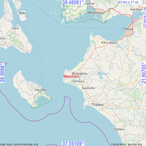
Neochóri GPS coordinates[2]
37° 54' 28.584" North, 21° 12' 14.112" East
| Map corner | latitude | longitude |
|---|---|---|
| Upper-left | 38.46061°, | 20.5008° |
| Center: | 37.90794°, | 21.20392° |
| Lower-right: | 37.35109°, | 21.90705° |
| Map W x H: | 123.4×123.4 km | = 76.7×76.7mi |
| max Lat: | 41.72048° ⇑77.7% North |
| Neochóri: | 37.90794° |
| min Lat: | ⇓22.3% South 34.8346° |
| min Long | Neochóri | max Long |
| 19.40494° | 21.20392° | 29.59361° |
| W 12.3%⇐ | ⇒87.7% E |
Elevation
Elevation of Neochóri is 10 m = 33 ft, and this is 158.9 m = 521 ft below average elevation for this country.
| Max E: |
1439 m = 4721 ft | 87.7% |
| Avg. | 168.9 m = 554 ft | |
| Neochóri | 10 m = 33 ft | |
Min E: |
0 m = 0 ft | 12.3% |
See also: Greece elevation on elevation.city.
Geographical zone
Neochóri is located in North temperate zone (between Tropic of Cancer and the Arctic Circle). Distance of this Northern Tropic circle is 1609 km =999.8 mi to South.| Distance of | km | miles | from Neochóri |
|---|---|---|---|
| North Pole | 5792.1 | 3599 | to North |
| Arctic Circle | 3186.2 | 1979.8 | to North |
| Tropic Cancer | 1609 | 999.8 | to South |
| Equator | 4215 | 2619.1 | to South |


Nearby cities:
15 places around Neochóri: (largest is in red/bold)
• Amaliáda
17.7 km =11 mi,  133°
133°
• Andravída
5.7 km =3.5 mi,  92°
92°
• Arkoúdi
10.7 km =6.6 mi,  230°
230°
• Chávari
17.1 km =10.6 mi,  112°
112°
• Gastoúni
7.6 km =4.7 mi,  147°
147°
• Kavásila
6.4 km =4 mi,  124°
124°
• Kyllíni
6 km =3.7 mi,  300°
300°
• Káto Panagía
5.5 km =3.4 mi, 296°
• Lechainá
6.2 km =3.9 mi,  62°
62°
• Myrsíni
3.3 km =2.1 mi, 63°
• Savália
12.5 km =7.8 mi,  140°
140°
• Synoikismós Chavaríou
17.2 km =10.7 mi, 109°
• Traganón
9.6 km =6 mi,  96°
96°
• Vartholomió
5.1 km =3.2 mi,  178°
178°
• Íkaros
2.8 km =1.7 mi, 299°
Sources, notices
• [Note1] Compared only with cities in Greece existing in our database
• [Src1] Map data: © OpenStreetMap contributors (CC-BY-SA)
• [Src2] Other city data from geonames.org with taken over terms of usage.
• [Src3] Geographical zone / Annual Mean Temperature by Robert A. Rohde @ Wikipedia
