Amaliáda geodata
Amaliáda (West Greece) is a seat of a third-order administrative division; located in Greece in Europe/Athens (GMT+3) time zone. With population of 16,763 people, there are 101 cities with bigger population in this country. Compared to other cities in Greece, 80.1% of cities are located further ↑North; 85.2% of cities are located further →East and 57.7% of cities have higher elevation than Amaliáda. Note1
Administrative division(s):
- Level 1: West Greece
- Level 2: Nomós Ileías
- Level 3: Dimos Ilida (Dimos Ilidas)


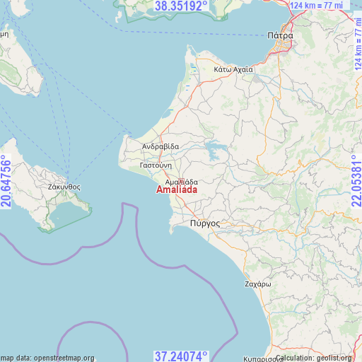
Amaliáda GPS coordinates[2]
37° 47' 54.312" North, 21° 21' 2.448" East
| Map corner | latitude | longitude |
|---|---|---|
| Upper-left | 38.35192°, | 20.64756° |
| Center: | 37.79842°, | 21.35068° |
| Lower-right: | 37.24074°, | 22.05381° |
| Map W x H: | 123.6×123.6 km | = 76.8×76.8mi |
| max Lat: | 41.72048° ⇑80.1% North |
| Amaliáda: | 37.79842° |
| min Lat: | ⇓19.9% South 34.8346° |
| min Long | Amaliáda | max Long |
| 19.40494° | 21.35068° | 29.59361° |
| W 14.8%⇐ | ⇒85.2% E |
Elevation
Elevation of Amaliáda is 57 m = 187 ft, and this is 111.9 m = 367 ft below average elevation for this country.
| Max E: |
1439 m = 4721 ft | 57.7% |
| Avg. | 168.9 m = 554 ft | |
| Amaliáda | 57 m = 187 ft | |
Min E: |
0 m = 0 ft | 42.3% |
See also: Greece elevation on elevation.city.
Geographical zone
Amaliáda is located in North temperate zone (between Tropic of Cancer and the Arctic Circle). Distance of this Northern Tropic circle is 1596.9 km =992.3 mi to South.| Distance of | km | miles | from Amaliáda |
|---|---|---|---|
| North Pole | 5804.3 | 3606.6 | to North |
| Arctic Circle | 3198.4 | 1987.4 | to North |
| Tropic Cancer | 1596.9 | 992.3 | to South |
| Equator | 4202.8 | 2611.5 | to South |


Nearby cities:
15 places around Amaliáda: (largest is in red/bold)
• Andravída
13.9 km =8.6 mi,  329°
329°
• Chávari
6.3 km =3.9 mi,  27°
27°
• Gastoúni
10.5 km =6.5 mi,  302°
302°
• Kardamás
3.6 km =2.2 mi,  195°
195°
• Karátoula
17.7 km =11 mi,  113°
113°
• Katákolo
16.1 km =10 mi,  190°
190°
• Kavásila
11.5 km =7.1 mi,  318°
318°
• Lechainá
16.7 km =10.4 mi, 333°
• Myrsíni
16.9 km =10.5 mi, 323°
• Myrtiá
9.4 km =5.8 mi,  180°
180°
• Pýrgos
15.8 km =9.8 mi,  149°
149°
• Savália
5.6 km =3.5 mi, 297°
• Synoikismós Chavaríou
7.2 km =4.5 mi, 27°
• Traganón
11.6 km =7.2 mi,  343°
343°
• Vartholomió
14.6 km =9.1 mi, 299°
Sources, notices
• [Note1] Compared only with cities in Greece existing in our database
• [Src1] Map data: © OpenStreetMap contributors (CC-BY-SA)
• [Src2] Other city data from geonames.org with taken over terms of usage.
• [Src3] Geographical zone / Annual Mean Temperature by Robert A. Rohde @ Wikipedia
