Moskhokhórion geodata
Moskhokhórion (Central Greece) is a populated place; located in Greece in Europe/Athens (GMT+3) time zone. With population of 822 people, there are 1241 cities with bigger population in this country. Compared to other cities in Greece, 57% of cities are located further ↑North; 61.5% of cities are located further →East and 83.9% of cities have higher elevation than Moskhokhórion. Note1


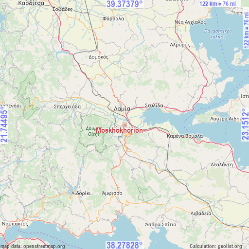
Moskhokhórion GPS coordinates[2]
38° 49' 41.304" North, 22° 26' 53.052" East
| Map corner | latitude | longitude |
|---|---|---|
| Upper-left | 39.37379°, | 21.74495° |
| Center: | 38.82814°, | 22.44807° |
| Lower-right: | 38.27828°, | 23.1512° |
| Map W x H: | 121.8×121.8 km | = 75.7×75.7mi |
| max Lat: | 41.72048° ⇑57% North |
| Moskhokhórion: | 38.82814° |
| min Lat: | ⇓43% South 34.8346° |
| min Long | Moskhokhórion | max Long |
| 19.40494° | 22.44807° | 29.59361° |
| W 38.5%⇐ | ⇒61.5% E |
Elevation
Elevation of Moskhokhórion is 14 m = 46 ft, and this is 154.9 m = 508 ft below average elevation for this country.
| Max E: |
1439 m = 4721 ft | 83.9% |
| Avg. | 168.9 m = 554 ft | |
| Moskhokhórion | 14 m = 46 ft | |
Min E: |
0 m = 0 ft | 16.1% |
See also: Greece elevation on elevation.city.
Geographical zone
Moskhokhórion is located in North temperate zone (between Tropic of Cancer and the Arctic Circle). Distance of this Northern Tropic circle is 1711.4 km =1063.4 mi to South.| Distance of | km | miles | from Moskhokhórion |
|---|---|---|---|
| North Pole | 5689.8 | 3535.5 | to North |
| Arctic Circle | 3083.9 | 1916.2 | to North |
| Tropic Cancer | 1711.4 | 1063.4 | to South |
| Equator | 4317.3 | 2682.6 | to South |


Nearby cities:
15 places around Moskhokhórion: (largest is in red/bold)
• Agía Paraskeví Lamiéon
8.9 km =5.5 mi,  24°
24°
• Anthíli
3.6 km =2.2 mi,  47°
47°
• Frantzís
5.7 km =3.5 mi,  294°
294°
• Kainoúryion
24.3 km =15.1 mi,  99°
99°
• Karavómilos
23.5 km =14.6 mi,  73°
73°
• Kompotádes
9.7 km =6 mi,  296°
296°
• Lamía
8.1 km =5 mi,  350°
350°
• Lianokládhion
15.9 km =9.9 mi,  308°
308°
• Megáli Vrísi
7.7 km =4.8 mi, 17°
• Mexiátai
13.1 km =8.1 mi, 297°
• Mólos
17.2 km =10.7 mi, 96°
• Rodhítsa
6.8 km =4.2 mi,  11°
11°
• Stavrós
10.1 km =6.3 mi,  318°
318°
• Stylída
17.6 km =10.9 mi,  56°
56°
• Áyios Serafím
22.4 km =13.9 mi, 97°
Sources, notices
• [Note1] Compared only with cities in Greece existing in our database
• [Src1] Map data: © OpenStreetMap contributors (CC-BY-SA)
• [Src2] Other city data from geonames.org with taken over terms of usage.
• [Src3] Geographical zone / Annual Mean Temperature by Robert A. Rohde @ Wikipedia
