Lianokládhion geodata
Lianokládhion (Central Greece) is a populated place; located in Greece in Europe/Athens (GMT+3) time zone. With population of 1,085 people, there are 932 cities with bigger population in this country. Compared to other cities in Greece, 55.2% of cities are located further ↑North; 65.2% of cities are located further →East and 56.8% of cities have higher elevation than Lianokládhion. Note1


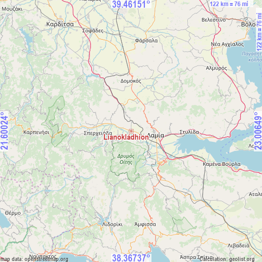
Lianokládhion GPS coordinates[2]
38° 54' 59.58" North, 22° 18' 12.096" East
| Map corner | latitude | longitude |
|---|---|---|
| Upper-left | 39.46151°, | 21.60024° |
| Center: | 38.91655°, | 22.30336° |
| Lower-right: | 38.36737°, | 23.00649° |
| Map W x H: | 121.7×121.7 km | = 75.6×75.6mi |
| max Lat: | 41.72048° ⇑55.2% North |
| Lianokládhion: | 38.91655° |
| min Lat: | ⇓44.8% South 34.8346° |
| min Long | Lianokládhion | max Long |
| 19.40494° | 22.30336° | 29.59361° |
| W 34.8%⇐ | ⇒65.2% E |
Elevation
Elevation of Lianokládhion is 60 m = 197 ft, and this is 108.9 m = 357 ft below average elevation for this country.
| Max E: |
1439 m = 4721 ft | 56.8% |
| Avg. | 168.9 m = 554 ft | |
| Lianokládhion | 60 m = 197 ft | |
Min E: |
0 m = 0 ft | 43.2% |
See also: Greece elevation on elevation.city.
Geographical zone
Lianokládhion is located in North temperate zone (between Tropic of Cancer and the Arctic Circle). Distance of this Northern Tropic circle is 1721.2 km =1069.5 mi to South.| Distance of | km | miles | from Lianokládhion |
|---|---|---|---|
| North Pole | 5679.9 | 3529.3 | to North |
| Arctic Circle | 3074.1 | 1910.2 | to North |
| Tropic Cancer | 1721.2 | 1069.5 | to South |
| Equator | 4327.1 | 2688.7 | to South |


Nearby cities:
15 places around Lianokládhion: (largest is in red/bold)
• Agía Paraskeví Lamiéon
16.3 km =10.1 mi,  96°
96°
• Anthíli
16.9 km =10.5 mi,  115°
115°
• Domokós
23.4 km =14.5 mi,  359°
359°
• Frantzís
10.4 km =6.5 mi,  135°
135°
• Ftéri
22.3 km =13.9 mi,  265°
265°
• Kompotádes
6.7 km =4.2 mi, 144°
• Lamía
11.4 km =7.1 mi, 99°
• Makrakómi
16.5 km =10.3 mi,  279°
279°
• Megáli Vrísi
15.1 km =9.4 mi, 99°
• Mexiátai
3.8 km =2.4 mi,  166°
166°
• Moskhokhórion
15.9 km =9.9 mi,  128°
128°
• Omvriakí
20.7 km =12.9 mi,  352°
352°
• Rodhítsa
14.3 km =8.9 mi, 102°
• Spercheiáda
15.2 km =9.4 mi, 265°
• Stavrós
6.3 km =3.9 mi,  110°
110°
Sources, notices
• [Note1] Compared only with cities in Greece existing in our database
• [Src1] Map data: © OpenStreetMap contributors (CC-BY-SA)
• [Src2] Other city data from geonames.org with taken over terms of usage.
• [Src3] Geographical zone / Annual Mean Temperature by Robert A. Rohde @ Wikipedia
