Mýtikas geodata
Mýtikas (West Greece) is a populated place; located in Greece in Europe/Athens (GMT+3) time zone. With population of 759 people, there are 1322 cities with bigger population in this country. Compared to other cities in Greece, 58.7% of cities are located further ↑North; 90.4% of cities are located further →East and 99.6% of cities have higher elevation than Mýtikas. Note1
Administrative division(s):
- Level 1: West Greece
- Level 2: Nomós Aitolías kai Akarnanías
- Level 3: Dimos Xiromero


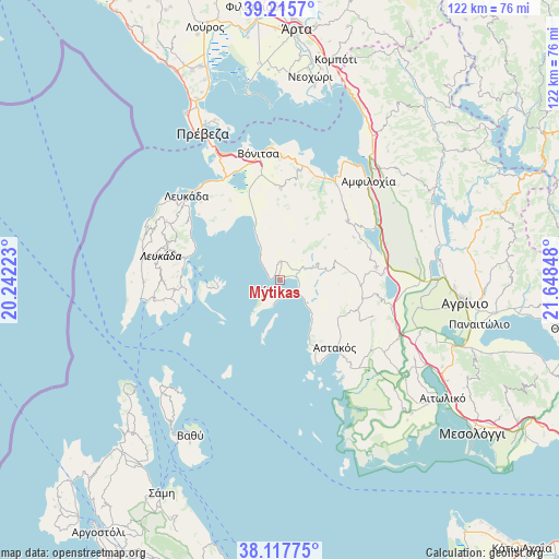
Mýtikas GPS coordinates[2]
38° 40' 7.788" North, 20° 56' 43.26" East
| Map corner | latitude | longitude |
|---|---|---|
| Upper-left | 39.2157°, | 20.24223° |
| Center: | 38.66883°, | 20.94535° |
| Lower-right: | 38.11775°, | 21.64848° |
| Map W x H: | 122.1×122.1 km | = 75.9×75.9mi |
| max Lat: | 41.72048° ⇑58.7% North |
| Mýtikas: | 38.66883° |
| min Lat: | ⇓41.3% South 34.8346° |
| min Long | Mýtikas | max Long |
| 19.40494° | 20.94535° | 29.59361° |
| W 9.6%⇐ | ⇒90.4% E |
Elevation
Elevation of Mýtikas is 1 m = 3 ft, and this is 167.9 m = 551 ft below average elevation for this country.
| Max E: |
1439 m = 4721 ft | 99.6% |
| Avg. | 168.9 m = 554 ft | |
| Mýtikas | 1 m = 3 ft | |
Min E: |
0 m = 0 ft | 0.4% |
See also: Greece elevation on elevation.city.
Geographical zone
Mýtikas is located in North temperate zone (between Tropic of Cancer and the Arctic Circle). Distance of this Northern Tropic circle is 1693.7 km =1052.4 mi to South.| Distance of | km | miles | from Mýtikas |
|---|---|---|---|
| North Pole | 5707.5 | 3546.5 | to North |
| Arctic Circle | 3101.6 | 1927.2 | to North |
| Tropic Cancer | 1693.7 | 1052.4 | to South |
| Equator | 4299.6 | 2671.6 | to South |


Nearby cities:
15 places around Mýtikas: (largest is in red/bold)
• Archontochóri
8.9 km =5.5 mi,  66°
66°
• Astakós
19 km =11.8 mi,  141°
141°
• Fyteíes
21 km =13 mi,  81°
81°
• Kandíla
4.1 km =2.5 mi,  2°
2°
• Karaïskákis
16 km =9.9 mi,  127°
127°
• Katoúna
19.6 km =12.2 mi,  48°
48°
• Ligia
23.6 km =14.7 mi,  303°
303°
• Monastiráki
20.2 km =12.6 mi,  359°
359°
• Nidhríon
20.6 km =12.8 mi,  282°
282°
• Nikiána
22.1 km =13.7 mi, 297°
• Plagiá
22.9 km =14.2 mi,  309°
309°
• Pálairos
13.8 km =8.6 mi,  336°
336°
• Thýrio
21.1 km =13.1 mi,  8°
8°
• Trýfos
20.4 km =12.7 mi,  33°
33°
• Vasilópoulo
15.1 km =9.4 mi,  124°
124°
Sources, notices
• [Note1] Compared only with cities in Greece existing in our database
• [Src1] Map data: © OpenStreetMap contributors (CC-BY-SA)
• [Src2] Other city data from geonames.org with taken over terms of usage.
• [Src3] Geographical zone / Annual Mean Temperature by Robert A. Rohde @ Wikipedia
