Vasilópoulo geodata
Vasilópoulo (West Greece) is a populated place; located in Greece in Europe/Athens (GMT+3) time zone. With population of 636 people, there are 1517 cities with bigger population in this country. Compared to other cities in Greece, 60% of cities are located further ↑North; 89% of cities are located further →East and 57.7% of cities have higher elevation than Vasilópoulo. Note1
Administrative division(s):
- Level 1: West Greece
- Level 2: Nomós Aitolías kai Akarnanías
- Level 3: Dimos Xiromero


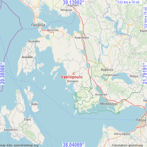
Vasilópoulo GPS coordinates[2]
38° 35' 32.496" North, 21° 5' 19.608" East
| Map corner | latitude | longitude |
|---|---|---|
| Upper-left | 39.13982°, | 20.38566° |
| Center: | 38.59236°, | 21.08878° |
| Lower-right: | 38.04069°, | 21.79191° |
| Map W x H: | 122.2×122.2 km | = 75.9×75.9mi |
| max Lat: | 41.72048° ⇑60% North |
| Vasilópoulo: | 38.59236° |
| min Lat: | ⇓40% South 34.8346° |
| min Long | Vasilópoulo | max Long |
| 19.40494° | 21.08878° | 29.59361° |
| W 11%⇐ | ⇒89% E |
Elevation
Elevation of Vasilópoulo is 57 m = 187 ft, and this is 111.9 m = 367 ft below average elevation for this country.
| Max E: |
1439 m = 4721 ft | 57.7% |
| Avg. | 168.9 m = 554 ft | |
| Vasilópoulo | 57 m = 187 ft | |
Min E: |
0 m = 0 ft | 42.3% |
See also: Greece elevation on elevation.city.
Geographical zone
Vasilópoulo is located in North temperate zone (between Tropic of Cancer and the Arctic Circle). Distance of this Northern Tropic circle is 1685.1 km =1047.1 mi to South.| Distance of | km | miles | from Vasilópoulo |
|---|---|---|---|
| North Pole | 5716 | 3551.8 | to North |
| Arctic Circle | 3110.1 | 1932.5 | to North |
| Tropic Cancer | 1685.1 | 1047.1 | to South |
| Equator | 4291.1 | 2666.4 | to South |


Nearby cities:
15 places around Vasilópoulo: (largest is in red/bold)
• Angelókastro
18.3 km =11.4 mi,  99°
99°
• Archontochóri
12.8 km =8 mi,  340°
340°
• Astakós
6.3 km =3.9 mi,  185°
185°
• Fyteíes
14.1 km =8.8 mi,  36°
36°
• Gouriá
20 km =12.4 mi,  131°
131°
• Kalývia
17.9 km =11.1 mi,  81°
81°
• Kandíla
17.6 km =10.9 mi,  315°
315°
• Karaïskákis
1.2 km =0.7 mi,  168°
168°
• Lesíni
20 km =12.4 mi,  141°
141°
• Mýtikas
15.1 km =9.4 mi,  304°
304°
• Palaiománina
13.9 km =8.6 mi,  108°
108°
• Pendálofon
18.2 km =11.3 mi, 131°
• Stamná
18.9 km =11.7 mi,  117°
117°
• Strátos
21.4 km =13.3 mi,  67°
67°
• Ókhthia
18.6 km =11.6 mi, 66°
Sources, notices
• [Note1] Compared only with cities in Greece existing in our database
• [Src1] Map data: © OpenStreetMap contributors (CC-BY-SA)
• [Src2] Other city data from geonames.org with taken over terms of usage.
• [Src3] Geographical zone / Annual Mean Temperature by Robert A. Rohde @ Wikipedia
