Fyteíes geodata
Fyteíes (West Greece) is a populated place; located in Greece in Europe/Athens (GMT+3) time zone. With population of 1,516 people, there are 656 cities with bigger population in this country. Compared to other cities in Greece, 58.6% of cities are located further ↑North; 87.9% of cities are located further →East and 84.6% of cities have lower elevation than Fyteíes. Note1
Administrative division(s):
- Level 1: West Greece
- Level 2: Nomós Aitolías kai Akarnanías
- Level 3: Dimos Xiromero


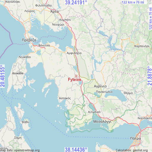
Fyteíes GPS coordinates[2]
38° 41' 42.864" North, 21° 11' 4.812" East
| Map corner | latitude | longitude |
|---|---|---|
| Upper-left | 39.24191°, | 20.48155° |
| Center: | 38.69524°, | 21.18467° |
| Lower-right: | 38.14436°, | 21.8878° |
| Map W x H: | 122×122 km | = 75.8×75.8mi |
| max Lat: | 41.72048° ⇑58.6% North |
| Fyteíes: | 38.69524° |
| min Lat: | ⇓41.4% South 34.8346° |
| min Long | Fyteíes | max Long |
| 19.40494° | 21.18467° | 29.59361° |
| W 12.1%⇐ | ⇒87.9% E |
Elevation
Elevation of Fyteíes is 368 m = 1207 ft, and this is 199.1 m = 653 ft above average elevation for this country.
| Max E: |
1439 m = 4721 ft | 15.4% |
| Fyteíes | 368 m 1207 ft | |
| Avg. | 168.9 m = 554 ft | |
Min E: |
0 m = 0 ft | 84.6% |
See also: Greece elevation on elevation.city.
Geographical zone
Fyteíes is located in North temperate zone (between Tropic of Cancer and the Arctic Circle). Distance of this Northern Tropic circle is 1696.6 km =1054.2 mi to South.| Distance of | km | miles | from Fyteíes |
|---|---|---|---|
| North Pole | 5704.6 | 3544.7 | to North |
| Arctic Circle | 3098.7 | 1925.4 | to North |
| Tropic Cancer | 1696.6 | 1054.2 | to South |
| Equator | 4302.5 | 2673.4 | to South |


Nearby cities:
15 places around Fyteíes: (largest is in red/bold)
• Angelókastro
17.3 km =10.7 mi,  146°
146°
• Archontochóri
12.7 km =7.9 mi,  272°
272°
• Kalývia
12.7 km =7.9 mi,  132°
132°
• Karaïskákis
15 km =9.3 mi,  212°
212°
• Katoúna
11.7 km =7.3 mi,  328°
328°
• Lepenoú
9.2 km =5.7 mi,  80°
80°
• Megáli Khóra
17.2 km =10.7 mi,  108°
108°
• Neápolis
15.7 km =9.8 mi,  99°
99°
• Palaiománina
16.6 km =10.3 mi,  162°
162°
• Spoláïta
14.1 km =8.8 mi,  89°
89°
• Strátos
11.8 km =7.3 mi, 105°
• Stános
12.2 km =7.6 mi,  355°
355°
• Trýfos
17 km =10.6 mi, 326°
• Vasilópoulo
14.1 km =8.8 mi,  216°
216°
• Ókhthia
9.7 km =6 mi,  115°
115°
Sources, notices
• [Note1] Compared only with cities in Greece existing in our database
• [Src1] Map data: © OpenStreetMap contributors (CC-BY-SA)
• [Src2] Other city data from geonames.org with taken over terms of usage.
• [Src3] Geographical zone / Annual Mean Temperature by Robert A. Rohde @ Wikipedia
