Krínes geodata
Krínes (Peloponnese) is a populated place; located in Greece in Europe/Athens (GMT+3) time zone. With population of 780 people, there are 1294 cities with bigger population in this country. Compared to other cities in Greece, 75.2% of cities are located further ↑North; 53% of cities are located further →East and 67.6% of cities have higher elevation than Krínes. Note1
Administrative division(s):
- Level 1: Peloponnese
- Level 2: Nomós Korinthías
- Level 3: Dimos Velo-Vocha


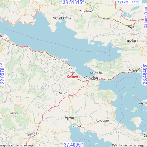
Krínes GPS coordinates[2]
37° 57' 57.312" North, 22° 45' 39.348" East
| Map corner | latitude | longitude |
|---|---|---|
| Upper-left | 38.51815°, | 22.05781° |
| Center: | 37.96592°, | 22.76093° |
| Lower-right: | 37.4095°, | 23.46406° |
| Map W x H: | 123.3×123.3 km | = 76.6×76.6mi |
| max Lat: | 41.72048° ⇑75.2% North |
| Krínes: | 37.96592° |
| min Lat: | ⇓24.8% South 34.8346° |
| min Long | Krínes | max Long |
| 19.40494° | 22.76093° | 29.59361° |
| W 47%⇐ | ⇒53% E |
Elevation
Elevation of Krínes is 35 m = 115 ft, and this is 133.9 m = 439 ft below average elevation for this country.
| Max E: |
1439 m = 4721 ft | 67.6% |
| Avg. | 168.9 m = 554 ft | |
| Krínes | 35 m = 115 ft | |
Min E: |
0 m = 0 ft | 32.4% |
See also: Greece elevation on elevation.city.
Geographical zone
Krínes is located in North temperate zone (between Tropic of Cancer and the Arctic Circle). Distance of this Northern Tropic circle is 1615.5 km =1003.8 mi to South.| Distance of | km | miles | from Krínes |
|---|---|---|---|
| North Pole | 5785.6 | 3595 | to North |
| Arctic Circle | 3179.8 | 1975.8 | to North |
| Tropic Cancer | 1615.5 | 1003.8 | to South |
| Equator | 4221.4 | 2623.1 | to South |


Nearby cities:
15 places around Krínes: (largest is in red/bold)
• Boláti
2.8 km =1.7 mi,  112°
112°
• Kiáto
5.4 km =3.4 mi,  348°
348°
• Kokkónion
1.8 km =1.1 mi,  72°
72°
• Káto Dhiminió
7 km =4.3 mi,  339°
339°
• Káto Ássos
6.4 km =4 mi, 108°
• Moúlki
4.4 km =2.7 mi,  314°
314°
• Nerántza
2.7 km =1.7 mi,  42°
42°
• Poullítsa
1.2 km =0.7 mi,  130°
130°
• Pásion
6 km =3.7 mi,  331°
331°
• Sikyón
3.7 km =2.3 mi,  299°
299°
• Vokhaïkó
3.3 km =2.1 mi, 125°
• Vrakháti
4 km =2.5 mi,  101°
101°
• Vélo
1.1 km =0.7 mi,  355°
355°
• Zevgolateió
5 km =3.1 mi,  136°
136°
• Ássos
6.1 km =3.8 mi,  118°
118°
Sources, notices
• [Note1] Compared only with cities in Greece existing in our database
• [Src1] Map data: © OpenStreetMap contributors (CC-BY-SA)
• [Src2] Other city data from geonames.org with taken over terms of usage.
• [Src3] Geographical zone / Annual Mean Temperature by Robert A. Rohde @ Wikipedia
