Káto Achaḯa geodata
Káto Achaḯa (West Greece) is a seat of a third-order administrative division; located in Greece in Europe/Athens (GMT+3) time zone. With population of 5,752 people, there are 212 cities with bigger population in this country. Compared to other cities in Greece, 68.9% of cities are located further ↑North; 82.1% of cities are located further →East and 100% of cities have higher elevation than Káto Achaḯa. Note1


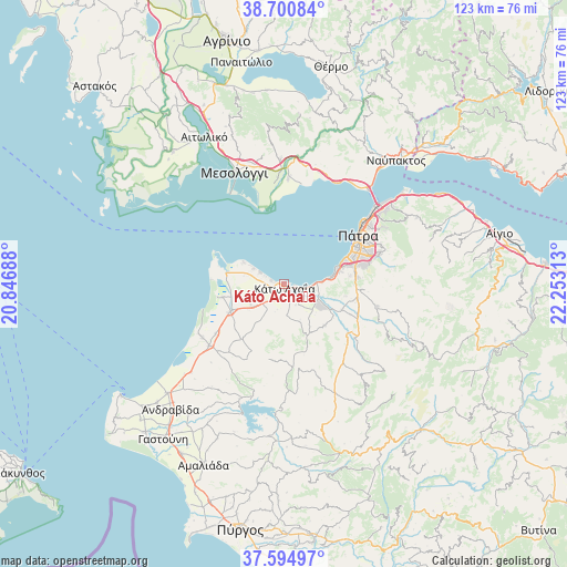
Káto Achaḯa GPS coordinates[2]
38° 9' 0" North, 21° 33' 0" East
| Map corner | latitude | longitude |
|---|---|---|
| Upper-left | 38.70084°, | 20.84688° |
| Center: | 38.15°, | 21.55° |
| Lower-right: | 37.59497°, | 22.25313° |
| Map W x H: | 123×123 km | = 76.4×76.4mi |
| max Lat: | 41.72048° ⇑68.9% North |
| Káto Achaḯa: | 38.15° |
| min Lat: | ⇓31.1% South 34.8346° |
| min Long | Káto Achaḯa | max Long |
| 19.40494° | 21.55° | 29.59361° |
| W 17.9%⇐ | ⇒82.1% E |
Elevation
Elevation of Káto Achaḯa is 0 m = 0 ft, and this is 168.9 m = 554 ft below average elevation for this country.
| Max E: |
1439 m = 4721 ft | 100% |
| Avg. | 168.9 m = 554 ft | |
| Káto Achaḯa | 0 m = 0 ft | |
Min E: |
0 m = 0 ft | 0% |
See also: Greece elevation on elevation.city.
Geographical zone
Káto Achaḯa is located in North temperate zone (between Tropic of Cancer and the Arctic Circle). Distance of this Northern Tropic circle is 1636 km =1016.6 mi to South.| Distance of | km | miles | from Káto Achaḯa |
|---|---|---|---|
| North Pole | 5765.2 | 3582.3 | to North |
| Arctic Circle | 3159.3 | 1963.1 | to North |
| Tropic Cancer | 1636 | 1016.6 | to South |
| Equator | 4241.9 | 2635.8 | to South |


Nearby cities:
15 places around Káto Achaḯa: (largest is in red/bold)
• Chalandrítsa
20.9 km =13 mi,  102°
102°
• Kamínia
6.4 km =4 mi,  90°
90°
• Káto Mazaráki
12.5 km =7.8 mi,  135°
135°
• Lakkopetra
8.6 km =5.3 mi,  286°
286°
• Limnokhórion
6.2 km =3.9 mi,  260°
260°
• Lápas
12.9 km =8 mi,  243°
243°
• Metóchi
13.4 km =8.3 mi, 258°
• Mindilóglion
13.8 km =8.6 mi,  74°
74°
• Monodhéndrion
11.6 km =7.2 mi,  77°
77°
• Néa Manoláda
18.2 km =11.3 mi,  233°
233°
• Ovriá
16.2 km =10.1 mi, 74°
• Paralía
14.4 km =8.9 mi, 68°
• Pátra
19.2 km =11.9 mi,  56°
56°
• Royítika
12.3 km =7.6 mi, 72°
• Vrachnaíika
10.3 km =6.4 mi, 82°
Sources, notices
• [Note1] Compared only with cities in Greece existing in our database
• [Src1] Map data: © OpenStreetMap contributors (CC-BY-SA)
• [Src2] Other city data from geonames.org with taken over terms of usage.
• [Src3] Geographical zone / Annual Mean Temperature by Robert A. Rohde @ Wikipedia
