Kamínia geodata
Kamínia (West Greece) is a populated place; located in Greece in Europe/Athens (GMT+3) time zone. With population of 716 people, there are 1391 cities with bigger population in this country. Compared to other cities in Greece, 69% of cities are located further ↑North; 80.5% of cities are located further →East and 92.5% of cities have higher elevation than Kamínia. Note1


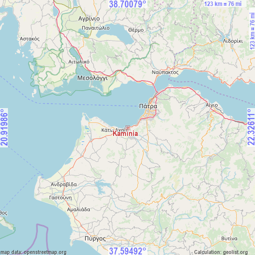
Kamínia GPS coordinates[2]
38° 8' 59.82" North, 21° 37' 22.728" East
| Map corner | latitude | longitude |
|---|---|---|
| Upper-left | 38.70079°, | 20.91986° |
| Center: | 38.14995°, | 21.62298° |
| Lower-right: | 37.59492°, | 22.32611° |
| Map W x H: | 123×123 km | = 76.4×76.4mi |
| max Lat: | 41.72048° ⇑69% North |
| Kamínia: | 38.14995° |
| min Lat: | ⇓31% South 34.8346° |
| min Long | Kamínia | max Long |
| 19.40494° | 21.62298° | 29.59361° |
| W 19.5%⇐ | ⇒80.5% E |
Elevation
Elevation of Kamínia is 7 m = 23 ft, and this is 161.9 m = 531 ft below average elevation for this country.
| Max E: |
1439 m = 4721 ft | 92.5% |
| Avg. | 168.9 m = 554 ft | |
| Kamínia | 7 m = 23 ft | |
Min E: |
0 m = 0 ft | 7.5% |
See also: Greece elevation on elevation.city.
Geographical zone
Kamínia is located in North temperate zone (between Tropic of Cancer and the Arctic Circle). Distance of this Northern Tropic circle is 1636 km =1016.6 mi to South.| Distance of | km | miles | from Kamínia |
|---|---|---|---|
| North Pole | 5765.2 | 3582.3 | to North |
| Arctic Circle | 3159.3 | 1963.1 | to North |
| Tropic Cancer | 1636 | 1016.6 | to South |
| Equator | 4241.9 | 2635.8 | to South |


Nearby cities:
15 places around Kamínia: (largest is in red/bold)
• Chalandrítsa
14.8 km =9.2 mi,  108°
108°
• Káto Achaḯa
6.4 km =4 mi,  270°
270°
• Káto Mazaráki
9.2 km =5.7 mi,  164°
164°
• Lakkopetra
14.8 km =9.2 mi,  279°
279°
• Limnokhórion
12.5 km =7.8 mi, 265°
• Lápas
18.8 km =11.7 mi,  251°
251°
• Metóchi
19.7 km =12.2 mi,  262°
262°
• Mindilóglion
7.8 km =4.8 mi,  61°
61°
• Monodhéndrion
5.5 km =3.4 mi, 63°
• Ovriá
10.2 km =6.3 mi,  65°
65°
• Paralía
8.8 km =5.5 mi,  52°
52°
• Pátra
14.3 km =8.9 mi,  42°
42°
• Royítika
6.5 km =4 mi, 55°
• Río
21.5 km =13.4 mi, 41°
• Vrachnaíika
4.1 km =2.5 mi, 69°
Sources, notices
• [Note1] Compared only with cities in Greece existing in our database
• [Src1] Map data: © OpenStreetMap contributors (CC-BY-SA)
• [Src2] Other city data from geonames.org with taken over terms of usage.
• [Src3] Geographical zone / Annual Mean Temperature by Robert A. Rohde @ Wikipedia
