Atsipópoulo geodata
Atsipópoulo (Crete) is a populated place; located in Greece in Europe/Athens (GMT+3) time zone. With population of 1,392 people, there are 727 cities with bigger population in this country. Compared to other cities in Greece, 95.6% of cities are located further ↑North; 83.2% of cities are located further ←West and 71% of cities have lower elevation than Atsipópoulo. Note1


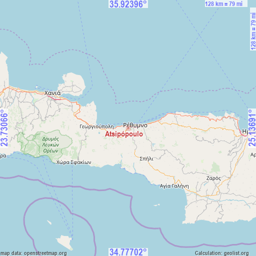
Atsipópoulo GPS coordinates[2]
35° 21' 9.108" North, 24° 26' 1.608" East
| Map corner | latitude | longitude |
|---|---|---|
| Upper-left | 35.92396°, | 23.73066° |
| Center: | 35.35253°, | 24.43378° |
| Lower-right: | 34.77702°, | 25.13691° |
| Map W x H: | 127.5×127.5 km | = 79.2×79.2mi |
| max Lat: | 41.72048° ⇑95.6% North |
| Atsipópoulo: | 35.35253° |
| min Lat: | ⇓4.4% South 34.8346° |
| min Long | Atsipópoulo | max Long |
| 19.40494° | 24.43378° | 29.59361° |
| W 83.2%⇐ | ⇒16.8% E |
Elevation
Elevation of Atsipópoulo is 174 m = 571 ft, and this is 5.1 m = 17 ft above average elevation for this country.
| Max E: |
1439 m = 4721 ft | 29% |
| Atsipópoulo | 174 m 571 ft | |
| Avg. | 168.9 m = 554 ft | |
Min E: |
0 m = 0 ft | 71% |
See also: Greece elevation on elevation.city.
Geographical zone
Atsipópoulo is located in North temperate zone (between Tropic of Cancer and the Arctic Circle). Distance of this Northern Tropic circle is 1324.9 km =823.3 mi to South.| Distance of | km | miles | from Atsipópoulo |
|---|---|---|---|
| North Pole | 6076.2 | 3775.6 | to North |
| Arctic Circle | 3470.3 | 2156.3 | to North |
| Tropic Cancer | 1324.9 | 823.3 | to South |
| Equator | 3930.8 | 2442.5 | to South |


Nearby cities:
15 places around Atsipópoulo: (largest is in red/bold)
• Adelianós Kámpos
10 km =6.2 mi,  77°
77°
• Agía Foteiní
21.3 km =13.2 mi,  120°
120°
• Episkopí
9.3 km =5.8 mi,  253°
253°
• Georgioupolis
15.8 km =9.8 mi,  273°
273°
• Geráni
3 km =1.9 mi, 272°
• Gállos
1.8 km =1.1 mi,  110°
110°
• Prinés
1.1 km =0.7 mi,  225°
225°
• Rethymno
4.6 km =2.9 mi,  71°
71°
• Roussospíti
5.9 km =3.7 mi, 110°
• Sfakáki
13.9 km =8.6 mi, 76°
• Spílion
17.4 km =10.8 mi,  148°
148°
• Stavroménos Rethýmnis
14.6 km =9.1 mi, 76°
• Violí Charáki
0.8 km =0.5 mi,  32°
32°
• Vrýses
21.3 km =13.2 mi,  277°
277°
• Vámos
22 km =13.7 mi,  285°
285°
Sources, notices
• [Note1] Compared only with cities in Greece existing in our database
• [Src1] Map data: © OpenStreetMap contributors (CC-BY-SA)
• [Src2] Other city data from geonames.org with taken over terms of usage.
• [Src3] Geographical zone / Annual Mean Temperature by Robert A. Rohde @ Wikipedia
