Skoútari geodata
Skoútari (Central Macedonia) is a populated place; located in Greece in Europe/Athens (GMT+3) time zone. With population of 2,154 people, there are 478 cities with bigger population in this country. Compared to other cities in Greece, 92.7% of cities are located further ↓South; 64.9% of cities are located further ←West and 81.5% of cities have higher elevation than Skoútari. Note1


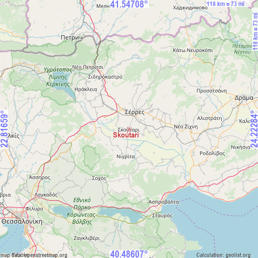
Skoútari GPS coordinates[2]
41° 1' 7.356" North, 23° 31' 10.956" East
| Map corner | latitude | longitude |
|---|---|---|
| Upper-left | 41.54708°, | 22.81659° |
| Center: | 41.01871°, | 23.51971° |
| Lower-right: | 40.48607°, | 24.22284° |
| Map W x H: | 118×118 km | = 73.3×73.3mi |
| max Lat: | 41.72048° ⇑7.3% North |
| Skoútari: | 41.01871° |
| min Lat: | ⇓92.7% South 34.8346° |
| min Long | Skoútari | max Long |
| 19.40494° | 23.51971° | 29.59361° |
| W 64.9%⇐ | ⇒35.1% E |
Elevation
Elevation of Skoútari is 16 m = 52 ft, and this is 152.9 m = 502 ft below average elevation for this country.
| Max E: |
1439 m = 4721 ft | 81.5% |
| Avg. | 168.9 m = 554 ft | |
| Skoútari | 16 m = 52 ft | |
Min E: |
0 m = 0 ft | 18.5% |
See also: Greece elevation on elevation.city.
Geographical zone
Skoútari is located in North temperate zone (between Tropic of Cancer and the Arctic Circle). Distance of this Northern Tropic circle is 1954.9 km =1214.7 mi to South.| Distance of | km | miles | from Skoútari |
|---|---|---|---|
| North Pole | 5446.2 | 3384.1 | to North |
| Arctic Circle | 2840.3 | 1764.9 | to North |
| Tropic Cancer | 1954.9 | 1214.7 | to South |
| Equator | 4560.9 | 2834 | to South |


Nearby cities:
15 places around Skoútari: (largest is in red/bold)
• Agía Paraskeví
9.3 km =5.8 mi,  214°
214°
• Anthí
8.4 km =5.2 mi,  187°
187°
• Dimitrítsi
9.7 km =6 mi,  247°
247°
• Flámpouro
10.5 km =6.5 mi,  157°
157°
• Káto Kamíla
3.1 km =1.9 mi,  275°
275°
• Lefkónas
9.3 km =5.8 mi,  347°
347°
• Mitroúsi
7.6 km =4.7 mi,  319°
319°
• Monóvrysi
8.5 km =5.3 mi,  57°
57°
• Neochóri
6.3 km =3.9 mi,  53°
53°
• Néos Skopós
7.5 km =4.7 mi,  85°
85°
• Psychikó
9.4 km =5.8 mi,  100°
100°
• Sérres
7.7 km =4.8 mi,  17°
17°
• Valtotópi
7 km =4.3 mi,  113°
113°
• Ágios Ioánnis
10.3 km =6.4 mi,  29°
29°
• Áno Kamíla
9.1 km =5.7 mi,  297°
297°
Sources, notices
• [Note1] Compared only with cities in Greece existing in our database
• [Src1] Map data: © OpenStreetMap contributors (CC-BY-SA)
• [Src2] Other city data from geonames.org with taken over terms of usage.
• [Src3] Geographical zone / Annual Mean Temperature by Robert A. Rohde @ Wikipedia
