Sykiá geodata
Sykiá (Central Macedonia) is a populated place; located in Greece in Europe/Athens (GMT+3) time zone. With population of 1,903 people, there are 548 cities with bigger population in this country. Compared to other cities in Greece, 67.1% of cities are located further ↓South; 77% of cities are located further ←West and 72.2% of cities have higher elevation than Sykiá. Note1
Administrative division(s):
- Level 1: Central Macedonia
- Level 2: Nomós Chalkidikís
- Level 3: Dimos Sithonia


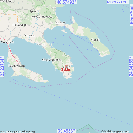
Sykiá GPS coordinates[2]
40° 2' 19.464" North, 23° 56' 25.656" East
| Map corner | latitude | longitude |
|---|---|---|
| Upper-left | 40.57493°, | 23.23734° |
| Center: | 40.03874°, | 23.94046° |
| Lower-right: | 39.4983°, | 24.64359° |
| Map W x H: | 119.7×119.7 km | = 74.4×74.4mi |
| max Lat: | 41.72048° ⇑32.9% North |
| Sykiá: | 40.03874° |
| min Lat: | ⇓67.1% South 34.8346° |
| min Long | Sykiá | max Long |
| 19.40494° | 23.94046° | 29.59361° |
| W 77%⇐ | ⇒23% E |
Elevation
Elevation of Sykiá is 27 m = 89 ft, and this is 141.9 m = 466 ft below average elevation for this country.
| Max E: |
1439 m = 4721 ft | 72.2% |
| Avg. | 168.9 m = 554 ft | |
| Sykiá | 27 m = 89 ft | |
Min E: |
0 m = 0 ft | 27.8% |
See also: Greece elevation on elevation.city.
Geographical zone
Sykiá is located in North temperate zone (between Tropic of Cancer and the Arctic Circle). Distance of this Northern Tropic circle is 1846 km =1147.1 mi to South.| Distance of | km | miles | from Sykiá |
|---|---|---|---|
| North Pole | 5555.2 | 3451.8 | to North |
| Arctic Circle | 2949.3 | 1832.6 | to North |
| Tropic Cancer | 1846 | 1147.1 | to South |
| Equator | 4451.9 | 2766.3 | to South |


Nearby cities:
15 places around Sykiá: (largest is in red/bold)
• Ammoulianí
32.7 km =20.3 mi,  357°
357°
• Karyes
35.5 km =22.1 mi,  46°
46°
• Khaniótis
31 km =19.3 mi,  261°
261°
• Kryopigí
39.7 km =24.7 mi,  269°
269°
• Metamórfosi
35.7 km =22.2 mi,  306°
306°
• Néa Róda
38.1 km =23.7 mi, 357°
• Néa Skióni
36.3 km =22.6 mi,  253°
253°
• Néos Marmarás
14.8 km =9.2 mi,  295°
295°
• Níkiti
30.8 km =19.1 mi, 311°
• Ouranoupolis
33 km =20.5 mi,  6°
6°
• Palioúri
26 km =16.2 mi, 245°
• Pefkochóri
28.5 km =17.7 mi, 258°
• Políkhronon
35.2 km =21.9 mi, 265°
• Sárti
6.9 km =4.3 mi,  27°
27°
• Ágios Nikólaos
31.3 km =19.4 mi,  318°
318°
Sources, notices
• [Note1] Compared only with cities in Greece existing in our database
• [Src1] Map data: © OpenStreetMap contributors (CC-BY-SA)
• [Src2] Other city data from geonames.org with taken over terms of usage.
• [Src3] Geographical zone / Annual Mean Temperature by Robert A. Rohde @ Wikipedia
