Níkiti geodata
Níkiti (Central Macedonia) is a seat of a third-order administrative division; located in Greece in Europe/Athens (GMT+3) time zone. With population of 2,711 people, there are 387 cities with bigger population in this country. Compared to other cities in Greece, 68.6% of cities are located further ↓South; 68.8% of cities are located further ←West and 83.9% of cities have higher elevation than Níkiti. Note1
Administrative division(s):
- Level 1: Central Macedonia
- Level 2: Nomós Chalkidikís
- Level 3: Dimos Sithonia


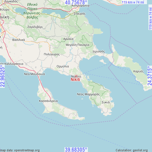
Níkiti GPS coordinates[2]
40° 13' 19.344" North, 23° 40' 6.132" East
| Map corner | latitude | longitude |
|---|---|---|
| Upper-left | 40.75678°, | 22.96525° |
| Center: | 40.22204°, | 23.66837° |
| Lower-right: | 39.68305°, | 24.3715° |
| Map W x H: | 119.4×119.4 km | = 74.2×74.2mi |
| max Lat: | 41.72048° ⇑31.4% North |
| Níkiti: | 40.22204° |
| min Lat: | ⇓68.6% South 34.8346° |
| min Long | Níkiti | max Long |
| 19.40494° | 23.66837° | 29.59361° |
| W 68.8%⇐ | ⇒31.2% E |
Elevation
Elevation of Níkiti is 14 m = 46 ft, and this is 154.9 m = 508 ft below average elevation for this country.
| Max E: |
1439 m = 4721 ft | 83.9% |
| Avg. | 168.9 m = 554 ft | |
| Níkiti | 14 m = 46 ft | |
Min E: |
0 m = 0 ft | 16.1% |
See also: Greece elevation on elevation.city.
Geographical zone
Níkiti is located in North temperate zone (between Tropic of Cancer and the Arctic Circle). Distance of this Northern Tropic circle is 1866.4 km =1159.7 mi to South.| Distance of | km | miles | from Níkiti |
|---|---|---|---|
| North Pole | 5534.8 | 3439.2 | to North |
| Arctic Circle | 2928.9 | 1819.9 | to North |
| Tropic Cancer | 1866.4 | 1159.7 | to South |
| Equator | 4472.3 | 2779 | to South |


Nearby cities:
15 places around Níkiti: (largest is in red/bold)
• Ammoulianí
24.7 km =15.3 mi,  60°
60°
• Gomáti
22.1 km =13.7 mi,  29°
29°
• Kallithéa
25.1 km =15.6 mi,  228°
228°
• Kalýves Polygýrou
24.7 km =15.3 mi,  286°
286°
• Megáli Panagía
24.8 km =15.4 mi,  2°
2°
• Metagkítsi
11.4 km =7.1 mi,  354°
354°
• Metamórfosi
5.6 km =3.5 mi,  279°
279°
• Néa Fókaia
25 km =15.5 mi,  246°
246°
• Néos Marmarás
17.1 km =10.6 mi,  145°
145°
• Ormýlia
13.3 km =8.3 mi,  307°
307°
• Políkhronon
25.8 km =16 mi,  207°
207°
• Taxiárchis
25.7 km =16 mi,  331°
331°
• Vrástama
20.1 km =12.5 mi, 326°
• Áfytos
24 km =14.9 mi,  235°
235°
• Ágios Nikólaos
3.8 km =2.4 mi,  37°
37°
Sources, notices
• [Note1] Compared only with cities in Greece existing in our database
• [Src1] Map data: © OpenStreetMap contributors (CC-BY-SA)
• [Src2] Other city data from geonames.org with taken over terms of usage.
• [Src3] Geographical zone / Annual Mean Temperature by Robert A. Rohde @ Wikipedia
