Palaiostáni geodata
Palaiostáni (Central Macedonia) is a populated place; located in Greece in Europe/Athens (GMT+3) time zone. With population of 612 people, there are 1562 cities with bigger population in this country. Compared to other cities in Greece, 72.3% of cities are located further ↓South; 61.1% of cities are located further →East and 83.3% of cities have lower elevation than Palaiostáni. Note1
Administrative division(s):
- Level 1: Central Macedonia
- Level 2: Nomós Pierías
- Level 3: Dimos Pydna-Kolindros


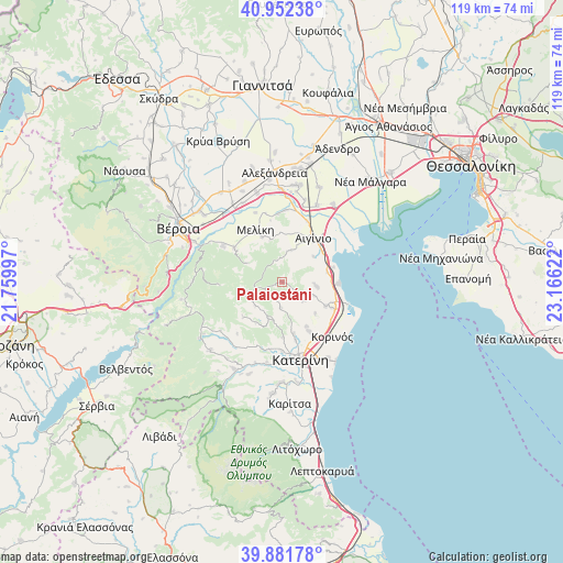
Palaiostáni GPS coordinates[2]
40° 25' 9.156" North, 22° 27' 47.124" East
| Map corner | latitude | longitude |
|---|---|---|
| Upper-left | 40.95238°, | 21.75997° |
| Center: | 40.41921°, | 22.46309° |
| Lower-right: | 39.88178°, | 23.16622° |
| Map W x H: | 119×119 km | = 73.9×73.9mi |
| max Lat: | 41.72048° ⇑27.7% North |
| Palaiostáni: | 40.41921° |
| min Lat: | ⇓72.3% South 34.8346° |
| min Long | Palaiostáni | max Long |
| 19.40494° | 22.46309° | 29.59361° |
| W 38.9%⇐ | ⇒61.1% E |
Elevation
Elevation of Palaiostáni is 344 m = 1129 ft, and this is 175.1 m = 574 ft above average elevation for this country.
| Max E: |
1439 m = 4721 ft | 16.7% |
| Palaiostáni | 344 m 1129 ft | |
| Avg. | 168.9 m = 554 ft | |
Min E: |
0 m = 0 ft | 83.3% |
See also: Greece elevation on elevation.city.
Geographical zone
Palaiostáni is located in North temperate zone (between Tropic of Cancer and the Arctic Circle). Distance of this Northern Tropic circle is 1888.3 km =1173.3 mi to South.| Distance of | km | miles | from Palaiostáni |
|---|---|---|---|
| North Pole | 5512.9 | 3425.6 | to North |
| Arctic Circle | 2907 | 1806.3 | to North |
| Tropic Cancer | 1888.3 | 1173.3 | to South |
| Equator | 4494.2 | 2792.6 | to South |


Nearby cities:
15 places around Palaiostáni: (largest is in red/bold)
• Aigínio
11.2 km =7 mi,  35°
35°
• Alónia
7.1 km =4.4 mi,  113°
113°
• Katachás
8.5 km =5.3 mi,  51°
51°
• Kolindrós
6.8 km =4.2 mi,  14°
14°
• Kítros
11 km =6.8 mi,  117°
117°
• Methóni
11.2 km =7 mi,  73°
73°
• Neókastro
10.4 km =6.5 mi,  337°
337°
• Néa Trapezoúnta
10.8 km =6.7 mi,  151°
151°
• Palaió Eleftherochóri
9.7 km =6 mi,  78°
78°
• Ryákia
6.3 km =3.9 mi,  251°
251°
• Sevastí
9.6 km =6 mi,  133°
133°
• Sfendámi
7.1 km =4.4 mi,  95°
95°
• Trílofos
5.4 km =3.4 mi,  184°
184°
• Áno Ágios Ioánnis
11.3 km =7 mi,  166°
166°
• Élafos
7.5 km =4.7 mi,  227°
227°
Sources, notices
• [Note1] Compared only with cities in Greece existing in our database
• [Src1] Map data: © OpenStreetMap contributors (CC-BY-SA)
• [Src2] Other city data from geonames.org with taken over terms of usage.
• [Src3] Geographical zone / Annual Mean Temperature by Robert A. Rohde @ Wikipedia
