Krithiá geodata
Krithiá (Central Macedonia) is a populated place; located in Greece in Europe/Athens (GMT+3) time zone. With population of 1,374 people, there are 741 cities with bigger population in this country. Compared to other cities in Greece, 87.1% of cities are located further ↓South; 54.3% of cities are located further ←West and 74.9% of cities have lower elevation than Krithiá. Note1
Administrative division(s):
- Level 1: Central Macedonia
- Level 2: Nomós Thessaloníkis
- Level 3: Dimos Lagkadas


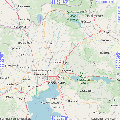
Krithiá GPS coordinates[2]
40° 50' 30.624" North, 22° 58' 58.512" East
| Map corner | latitude | longitude |
|---|---|---|
| Upper-left | 41.37163°, | 22.2798° |
| Center: | 40.84184°, | 22.98292° |
| Lower-right: | 40.30778°, | 23.68605° |
| Map W x H: | 118.3×118.3 km | = 73.5×73.5mi |
| max Lat: | 41.72048° ⇑12.9% North |
| Krithiá: | 40.84184° |
| min Lat: | ⇓87.1% South 34.8346° |
| min Long | Krithiá | max Long |
| 19.40494° | 22.98292° | 29.59361° |
| W 54.3%⇐ | ⇒45.7% E |
Elevation
Elevation of Krithiá is 209 m = 686 ft, and this is 40.1 m = 132 ft above average elevation for this country.
| Max E: |
1439 m = 4721 ft | 25.1% |
| Krithiá | 209 m 686 ft | |
| Avg. | 168.9 m = 554 ft | |
Min E: |
0 m = 0 ft | 74.9% |
See also: Greece elevation on elevation.city.
Geographical zone
Krithiá is located in North temperate zone (between Tropic of Cancer and the Arctic Circle). Distance of this Northern Tropic circle is 1935.3 km =1202.5 mi to South.| Distance of | km | miles | from Krithiá |
|---|---|---|---|
| North Pole | 5465.9 | 3396.4 | to North |
| Arctic Circle | 2860 | 1777.1 | to North |
| Tropic Cancer | 1935.3 | 1202.5 | to South |
| Equator | 4541.2 | 2821.8 | to South |


Nearby cities:
15 places around Krithiá: (largest is in red/bold)
• Drymós
7.1 km =4.4 mi,  196°
196°
• Gallikós
9.2 km =5.7 mi,  281°
281°
• Iráklion
10.4 km =6.5 mi,  154°
154°
• Kampánis
7.7 km =4.8 mi,  313°
313°
• Lagkadás
12.4 km =7.7 mi, 145°
• Lagyná
13.3 km =8.3 mi,  172°
172°
• Lití
10.7 km =6.6 mi,  181°
181°
• Melissochóri
9.4 km =5.8 mi,  209°
209°
• Neochoroúda
14.6 km =9.1 mi,  218°
218°
• Néa Filadélfeia
12.9 km =8 mi,  247°
247°
• Néa Sánta
5.2 km =3.2 mi,  268°
268°
• Oraiókastro
13.5 km =8.4 mi, 204°
• Pedinó
12 km =7.5 mi, 309°
• Perivolákion
11.7 km =7.3 mi,  157°
157°
• Ássiros
4.6 km =2.9 mi,  119°
119°
Sources, notices
• [Note1] Compared only with cities in Greece existing in our database
• [Src1] Map data: © OpenStreetMap contributors (CC-BY-SA)
• [Src2] Other city data from geonames.org with taken over terms of usage.
• [Src3] Geographical zone / Annual Mean Temperature by Robert A. Rohde @ Wikipedia
