Melissochóri geodata
Melissochóri (Central Macedonia) is a populated place; located in Greece in Europe/Athens (GMT+3) time zone. With population of 2,002 people, there are 519 cities with bigger population in this country. Compared to other cities in Greece, 84% of cities are located further ↓South; 52.4% of cities are located further ←West and 76% of cities have lower elevation than Melissochóri. Note1
Administrative division(s):
- Level 1: Central Macedonia
- Level 2: Nomós Thessaloníkis
- Level 3: Dimos Oraiokastro


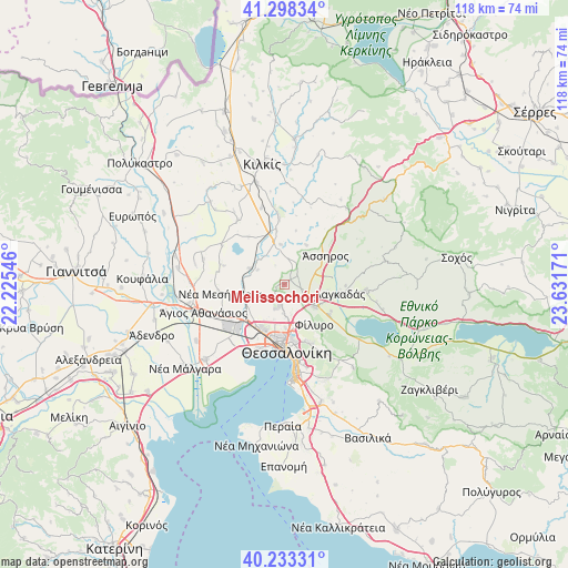
Melissochóri GPS coordinates[2]
40° 46' 4.656" North, 22° 55' 42.888" East
| Map corner | latitude | longitude |
|---|---|---|
| Upper-left | 41.29834°, | 22.22546° |
| Center: | 40.76796°, | 22.92858° |
| Lower-right: | 40.23331°, | 23.63171° |
| Map W x H: | 118.4×118.4 km | = 73.6×73.6mi |
| max Lat: | 41.72048° ⇑16% North |
| Melissochóri: | 40.76796° |
| min Lat: | ⇓84% South 34.8346° |
| min Long | Melissochóri | max Long |
| 19.40494° | 22.92858° | 29.59361° |
| W 52.4%⇐ | ⇒47.6% E |
Elevation
Elevation of Melissochóri is 221 m = 725 ft, and this is 52.1 m = 171 ft above average elevation for this country.
| Max E: |
1439 m = 4721 ft | 24% |
| Melissochóri | 221 m 725 ft | |
| Avg. | 168.9 m = 554 ft | |
Min E: |
0 m = 0 ft | 76% |
See also: Greece elevation on elevation.city.
Geographical zone
Melissochóri is located in North temperate zone (between Tropic of Cancer and the Arctic Circle). Distance of this Northern Tropic circle is 1927.1 km =1197.4 mi to South.| Distance of | km | miles | from Melissochóri |
|---|---|---|---|
| North Pole | 5474.1 | 3401.4 | to North |
| Arctic Circle | 2868.2 | 1782.2 | to North |
| Tropic Cancer | 1927.1 | 1197.4 | to South |
| Equator | 4533 | 2816.7 | to South |


Nearby cities:
15 places around Melissochóri: (largest is in red/bold)
• Diavatá
10.7 km =6.6 mi,  213°
213°
• Drymós
2.9 km =1.8 mi,  60°
60°
• Efkarpía
9.1 km =5.7 mi,  166°
166°
• Fíliro
10.6 km =6.6 mi,  143°
143°
• Iráklion
9.1 km =5.7 mi,  97°
97°
• Krithiá
9.4 km =5.8 mi,  29°
29°
• Lagyná
8.1 km =5 mi,  127°
127°
• Lití
5 km =3.1 mi,  120°
120°
• Neochoroúda
5.6 km =3.5 mi,  233°
233°
• Néa Filadélfeia
8.1 km =5 mi,  294°
294°
• Néa Sánta
8.1 km =5 mi,  355°
355°
• Oraiókastro
4.2 km =2.6 mi,  193°
193°
• Pentálofos
7 km =4.3 mi,  246°
246°
• Perivolákion
9.4 km =5.8 mi,  106°
106°
• Ássiros
10.4 km =6.5 mi, 55°
Sources, notices
• [Note1] Compared only with cities in Greece existing in our database
• [Src1] Map data: © OpenStreetMap contributors (CC-BY-SA)
• [Src2] Other city data from geonames.org with taken over terms of usage.
• [Src3] Geographical zone / Annual Mean Temperature by Robert A. Rohde @ Wikipedia
