Kavála geodata
Kavála (East Macedonia and Thrace) is a seat of a second-order administrative division; located in Greece in Europe/Athens (GMT+3) time zone. With population of 54,027 people, there are 35 cities with bigger population in this country. Compared to other cities in Greece, 89.8% of cities are located further ↓South; 82.7% of cities are located further ←West and 68.3% of cities have higher elevation than Kavála. Note1
Administrative division(s):
- Level 1: East Macedonia and Thrace
- Level 2: Nomós Kaválas
- Level 3: Dimos Kavala


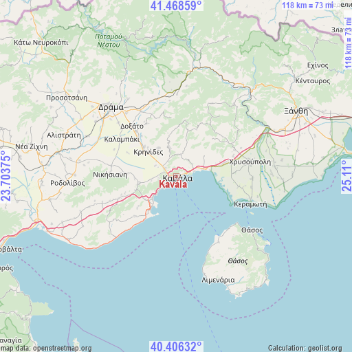
Kavála GPS coordinates[2]
40° 56' 22.524" North, 24° 24' 24.732" East
| Map corner | latitude | longitude |
|---|---|---|
| Upper-left | 41.46859°, | 23.70375° |
| Center: | 40.93959°, | 24.40687° |
| Lower-right: | 40.40632°, | 25.11° |
| Map W x H: | 118.1×118.1 km | = 73.4×73.4mi |
| max Lat: | 41.72048° ⇑10.2% North |
| Kavála: | 40.93959° |
| min Lat: | ⇓89.8% South 34.8346° |
| min Long | Kavála | max Long |
| 19.40494° | 24.40687° | 29.59361° |
| W 82.7%⇐ | ⇒17.3% E |
Elevation
Elevation of Kavála is 34 m = 112 ft, and this is 134.9 m = 443 ft below average elevation for this country.
| Max E: |
1439 m = 4721 ft | 68.3% |
| Avg. | 168.9 m = 554 ft | |
| Kavála | 34 m = 112 ft | |
Min E: |
0 m = 0 ft | 31.7% |
See also: Kavála elevation on elevation.city.
Geographical zone
Kavála is located in North temperate zone (between Tropic of Cancer and the Arctic Circle). Distance of this Northern Tropic circle is 1946.1 km =1209.3 mi to South.| Distance of | km | miles | from Kavála |
|---|---|---|---|
| North Pole | 5455 | 3389.6 | to North |
| Arctic Circle | 2849.1 | 1770.3 | to North |
| Tropic Cancer | 1946.1 | 1209.3 | to South |
| Equator | 4552.1 | 2828.5 | to South |


Nearby cities:
15 places around Kavála: (largest is in red/bold)
• Amisianá
5.8 km =3.6 mi,  262°
262°
• Amygdaleónas
4.7 km =2.9 mi,  304°
304°
• Eleftheroúpolis
13.4 km =8.3 mi, 257°
• Fílippoi
11.1 km =6.9 mi,  329°
329°
• Kokkinóchoma
8.4 km =5.2 mi, 260°
• Krinídes
12.4 km =7.7 mi,  311°
311°
• Kryonéri
9.8 km =6.1 mi,  345°
345°
• Lydía
14.6 km =9.1 mi, 313°
• Néa Iraklítsa
11.3 km =7 mi,  222°
222°
• Néa Karváli
9.1 km =5.7 mi,  74°
74°
• Néa Péramos
14.3 km =8.9 mi, 218°
• Palaió Tsiflíki
6.1 km =3.8 mi,  230°
230°
• Panagiá
14.6 km =9.1 mi,  251°
251°
• Prósfyges
5.8 km =3.6 mi, 332°
• Zygós
8.5 km =5.3 mi, 345°
In other languages:
- In Spanish: Kavala
- In France: Kavala
- In German: Kavala
- In Russian: Кавала
- In Chinese: 卡瓦拉
Sources, notices
• [Note1] Compared only with cities in Greece existing in our database
• [Src1] Map data: © OpenStreetMap contributors (CC-BY-SA)
• [Src2] Other city data from geonames.org with taken over terms of usage.
• [Src3] Geographical zone / Annual Mean Temperature by Robert A. Rohde @ Wikipedia
