Fílippoi geodata
Fílippoi (East Macedonia and Thrace) is a populated place; located in Greece in Europe/Athens (GMT+3) time zone. With population of 894 people, there are 1137 cities with bigger population in this country. Compared to other cities in Greece, 93% of cities are located further ↓South; 82.3% of cities are located further ←West and 71.9% of cities have lower elevation than Fílippoi. Note1
Administrative division(s):
- Level 1: East Macedonia and Thrace
- Level 2: Nomós Kaválas
- Level 3: Dimos Kavala


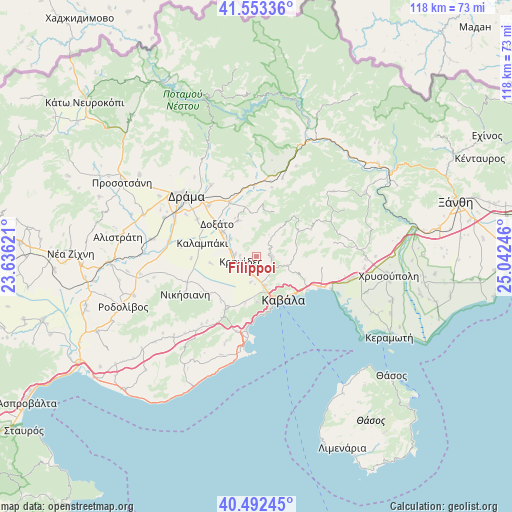
Fílippoi GPS coordinates[2]
41° 1' 30.144" North, 24° 20' 21.588" East
| Map corner | latitude | longitude |
|---|---|---|
| Upper-left | 41.55336°, | 23.63621° |
| Center: | 41.02504°, | 24.33933° |
| Lower-right: | 40.49245°, | 25.04246° |
| Map W x H: | 118×118 km | = 73.3×73.3mi |
| max Lat: | 41.72048° ⇑7% North |
| Fílippoi: | 41.02504° |
| min Lat: | ⇓93% South 34.8346° |
| min Long | Fílippoi | max Long |
| 19.40494° | 24.33933° | 29.59361° |
| W 82.3%⇐ | ⇒17.7% E |
Elevation
Elevation of Fílippoi is 180 m = 591 ft, and this is 11.1 m = 36 ft above average elevation for this country.
| Max E: |
1439 m = 4721 ft | 28.1% |
| Fílippoi | 180 m 591 ft | |
| Avg. | 168.9 m = 554 ft | |
Min E: |
0 m = 0 ft | 71.9% |
See also: Greece elevation on elevation.city.
Geographical zone
Fílippoi is located in North temperate zone (between Tropic of Cancer and the Arctic Circle). Distance of this Northern Tropic circle is 1955.6 km =1215.2 mi to South.| Distance of | km | miles | from Fílippoi |
|---|---|---|---|
| North Pole | 5445.5 | 3383.7 | to North |
| Arctic Circle | 2839.6 | 1764.4 | to North |
| Tropic Cancer | 1955.6 | 1215.2 | to South |
| Equator | 4561.6 | 2834.4 | to South |


Nearby cities:
15 places around Fílippoi: (largest is in red/bold)
• Amisianá
10.2 km =6.3 mi,  180°
180°
• Amygdaleónas
7.1 km =4.4 mi,  165°
165°
• Antifílippoi
13.9 km =8.6 mi,  230°
230°
• Fteliá
14.1 km =8.8 mi,  297°
297°
• Kalampáki
13.4 km =8.3 mi,  281°
281°
• Kavála
11.1 km =6.9 mi,  149°
149°
• Kokkinóchoma
11.2 km =7 mi,  193°
193°
• Krinídes
3.8 km =2.4 mi,  251°
251°
• Kryonéri
3.3 km =2.1 mi,  90°
90°
• Kýria
9.2 km =5.7 mi,  332°
332°
• Lydía
4.9 km =3 mi, 277°
• Palaió Tsiflíki
13.4 km =8.3 mi, 175°
• Prósfyges
5.3 km =3.3 mi, 145°
• Zygós
3.8 km =2.4 mi,  110°
110°
• Ágios Athanásios
9.6 km =6 mi,  305°
305°
Sources, notices
• [Note1] Compared only with cities in Greece existing in our database
• [Src1] Map data: © OpenStreetMap contributors (CC-BY-SA)
• [Src2] Other city data from geonames.org with taken over terms of usage.
• [Src3] Geographical zone / Annual Mean Temperature by Robert A. Rohde @ Wikipedia
