Prósfyges geodata
Prósfyges (East Macedonia and Thrace) is a populated place; located in Greece in Europe/Athens (GMT+3) time zone. With population of 572 people, there are 1646 cities with bigger population in this country. Compared to other cities in Greece, 91.6% of cities are located further ↓South; 82.5% of cities are located further ←West and 57.2% of cities have lower elevation than Prósfyges. Note1
Administrative division(s):
- Level 1: East Macedonia and Thrace
- Level 2: Nomós Kaválas
- Level 3: Dimos Kavala


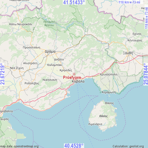
Prósfyges GPS coordinates[2]
40° 59' 8.52" North, 24° 22' 31.116" East
| Map corner | latitude | longitude |
|---|---|---|
| Upper-left | 41.51433°, | 23.67219° |
| Center: | 40.9857°, | 24.37531° |
| Lower-right: | 40.4528°, | 25.07844° |
| Map W x H: | 118×118 km | = 73.3×73.3mi |
| max Lat: | 41.72048° ⇑8.4% North |
| Prósfyges: | 40.9857° |
| min Lat: | ⇓91.6% South 34.8346° |
| min Long | Prósfyges | max Long |
| 19.40494° | 24.37531° | 29.59361° |
| W 82.5%⇐ | ⇒17.5% E |
Elevation
Elevation of Prósfyges is 106 m = 348 ft, and this is 62.9 m = 206 ft below average elevation for this country.
| Max E: |
1439 m = 4721 ft | 42.8% |
| Avg. | 168.9 m = 554 ft | |
| Prósfyges | 106 m = 348 ft | |
Min E: |
0 m = 0 ft | 57.2% |
See also: Greece elevation on elevation.city.
Geographical zone
Prósfyges is located in North temperate zone (between Tropic of Cancer and the Arctic Circle). Distance of this Northern Tropic circle is 1951.3 km =1212.5 mi to South.| Distance of | km | miles | from Prósfyges |
|---|---|---|---|
| North Pole | 5449.9 | 3386.4 | to North |
| Arctic Circle | 2844 | 1767.2 | to North |
| Tropic Cancer | 1951.3 | 1212.5 | to South |
| Equator | 4557.2 | 2831.7 | to South |


Nearby cities:
15 places around Prósfyges: (largest is in red/bold)
• Amisianá
6.6 km =4.1 mi,  207°
207°
• Amygdaleónas
2.8 km =1.7 mi, 207°
• Antifílippoi
14.5 km =9 mi,  252°
252°
• Eleftheroúpolis
13.1 km =8.1 mi,  232°
232°
• Fílippoi
5.3 km =3.3 mi,  325°
325°
• Kavála
5.8 km =3.6 mi,  152°
152°
• Kokkinóchoma
8.6 km =5.3 mi,  220°
220°
• Krinídes
7.3 km =4.5 mi,  295°
295°
• Kryonéri
4.4 km =2.7 mi,  3°
3°
• Kýria
14.5 km =9 mi, 330°
• Lydía
9.3 km =5.8 mi, 302°
• Néa Iraklítsa
14.4 km =8.9 mi,  200°
200°
• Néa Karváli
11.7 km =7.3 mi,  103°
103°
• Palaió Tsiflíki
9.2 km =5.7 mi,  192°
192°
• Zygós
3.1 km =1.9 mi,  9°
9°
Sources, notices
• [Note1] Compared only with cities in Greece existing in our database
• [Src1] Map data: © OpenStreetMap contributors (CC-BY-SA)
• [Src2] Other city data from geonames.org with taken over terms of usage.
• [Src3] Geographical zone / Annual Mean Temperature by Robert A. Rohde @ Wikipedia
