Agkathiá geodata
Agkathiá (Central Macedonia) is a populated place; located in Greece in Europe/Athens (GMT+3) time zone. With population of 1,459 people, there are 686 cities with bigger population in this country. Compared to other cities in Greece, 76.2% of cities are located further ↓South; 60.8% of cities are located further →East and 83.9% of cities have higher elevation than Agkathiá. Note1
Administrative division(s):
- Level 1: Central Macedonia
- Level 2: Nomós Imathías
- Level 3: Dimos Alexandreia


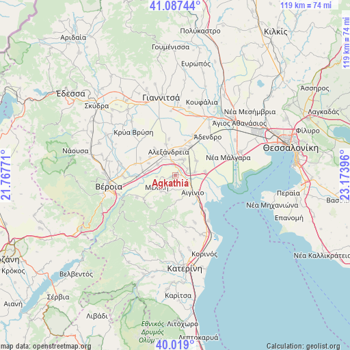
Agkathiá GPS coordinates[2]
40° 33' 19.26" North, 22° 28' 14.988" East
| Map corner | latitude | longitude |
|---|---|---|
| Upper-left | 41.08744°, | 21.76771° |
| Center: | 40.55535°, | 22.47083° |
| Lower-right: | 40.019°, | 23.17396° |
| Map W x H: | 118.8×118.8 km | = 73.8×73.8mi |
| max Lat: | 41.72048° ⇑23.8% North |
| Agkathiá: | 40.55535° |
| min Lat: | ⇓76.2% South 34.8346° |
| min Long | Agkathiá | max Long |
| 19.40494° | 22.47083° | 29.59361° |
| W 39.2%⇐ | ⇒60.8% E |
Elevation
Elevation of Agkathiá is 14 m = 46 ft, and this is 154.9 m = 508 ft below average elevation for this country.
| Max E: |
1439 m = 4721 ft | 83.9% |
| Avg. | 168.9 m = 554 ft | |
| Agkathiá | 14 m = 46 ft | |
Min E: |
0 m = 0 ft | 16.1% |
See also: Greece elevation on elevation.city.
Geographical zone
Agkathiá is located in North temperate zone (between Tropic of Cancer and the Arctic Circle). Distance of this Northern Tropic circle is 1903.4 km =1182.7 mi to South.| Distance of | km | miles | from Agkathiá |
|---|---|---|---|
| North Pole | 5497.7 | 3416.1 | to North |
| Arctic Circle | 2891.8 | 1796.9 | to North |
| Tropic Cancer | 1903.4 | 1182.7 | to South |
| Equator | 4509.3 | 2801.9 | to South |


Nearby cities:
15 places around Agkathiá: (largest is in red/bold)
• Aigínio
8.4 km =5.2 mi,  135°
135°
• Alexándreia
8.2 km =5.1 mi,  344°
344°
• Kefalochóri
9 km =5.6 mi,  279°
279°
• Kolindrós
8.6 km =5.3 mi,  172°
172°
• Koryfí
6.1 km =3.8 mi,  29°
29°
• Kypséli
1.9 km =1.2 mi,  88°
88°
• Lianovérgi
9.4 km =5.8 mi,  19°
19°
• Loutrós
7.1 km =4.4 mi,  301°
301°
• Melíki
7.6 km =4.7 mi,  235°
235°
• Neókastro
7.3 km =4.5 mi,  220°
220°
• Niséli
4.4 km =2.7 mi,  348°
348°
• Plátanos
6.8 km =4.2 mi,  81°
81°
• Pródromos
6.3 km =3.9 mi,  265°
265°
• Tríkala
8.7 km =5.4 mi,  56°
56°
• Vrysáki
9.2 km =5.7 mi,  321°
321°
Sources, notices
• [Note1] Compared only with cities in Greece existing in our database
• [Src1] Map data: © OpenStreetMap contributors (CC-BY-SA)
• [Src2] Other city data from geonames.org with taken over terms of usage.
• [Src3] Geographical zone / Annual Mean Temperature by Robert A. Rohde @ Wikipedia
