Kefalochóri geodata
Kefalochóri (Central Macedonia) is a populated place; located in Greece in Europe/Athens (GMT+3) time zone. With population of 792 people, there are 1281 cities with bigger population in this country. Compared to other cities in Greece, 76.6% of cities are located further ↓South; 63.6% of cities are located further →East and 83.9% of cities have higher elevation than Kefalochóri. Note1
Administrative division(s):
- Level 1: Central Macedonia
- Level 2: Nomós Imathías
- Level 3: Dimos Alexandreia


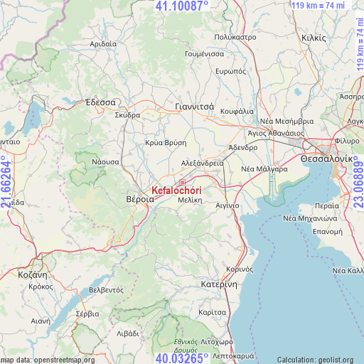
Kefalochóri GPS coordinates[2]
40° 34' 8.004" North, 22° 21' 56.736" East
| Map corner | latitude | longitude |
|---|---|---|
| Upper-left | 41.10087°, | 21.66264° |
| Center: | 40.56889°, | 22.36576° |
| Lower-right: | 40.03265°, | 23.06889° |
| Map W x H: | 118.8×118.8 km | = 73.8×73.8mi |
| max Lat: | 41.72048° ⇑23.4% North |
| Kefalochóri: | 40.56889° |
| min Lat: | ⇓76.6% South 34.8346° |
| min Long | Kefalochóri | max Long |
| 19.40494° | 22.36576° | 29.59361° |
| W 36.4%⇐ | ⇒63.6% E |
Elevation
Elevation of Kefalochóri is 14 m = 46 ft, and this is 154.9 m = 508 ft below average elevation for this country.
| Max E: |
1439 m = 4721 ft | 83.9% |
| Avg. | 168.9 m = 554 ft | |
| Kefalochóri | 14 m = 46 ft | |
Min E: |
0 m = 0 ft | 16.1% |
See also: Greece elevation on elevation.city.
Geographical zone
Kefalochóri is located in North temperate zone (between Tropic of Cancer and the Arctic Circle). Distance of this Northern Tropic circle is 1904.9 km =1183.6 mi to South.| Distance of | km | miles | from Kefalochóri |
|---|---|---|---|
| North Pole | 5496.2 | 3415.2 | to North |
| Arctic Circle | 2890.3 | 1795.9 | to North |
| Tropic Cancer | 1904.9 | 1183.6 | to South |
| Equator | 4510.8 | 2802.9 | to South |


Nearby cities:
15 places around Kefalochóri: (largest is in red/bold)
• Diavatós
8.7 km =5.4 mi,  253°
253°
• Episkopí
2.5 km =1.6 mi,  357°
357°
• Kampochóri
4.5 km =2.8 mi,  4°
4°
• Kavásila
3.8 km =2.4 mi,  311°
311°
• Kouloúra
4.7 km =2.9 mi,  238°
238°
• Loutrós
3.6 km =2.2 mi,  52°
52°
• Melíki
6.3 km =3.9 mi,  156°
156°
• Neókastro
8.2 km =5.1 mi,  149°
149°
• Niséli
8.5 km =5.3 mi,  70°
70°
• Nisí
7.7 km =4.8 mi,  14°
14°
• Palaió Skyllítsi
5.2 km =3.2 mi,  323°
323°
• Pródromos
3.3 km =2.1 mi,  127°
127°
• Stavrós
5.3 km =3.3 mi,  295°
295°
• Vrysáki
6.6 km =4.1 mi,  29°
29°
• Xechasméni
2.3 km =1.4 mi,  269°
269°
Sources, notices
• [Note1] Compared only with cities in Greece existing in our database
• [Src1] Map data: © OpenStreetMap contributors (CC-BY-SA)
• [Src2] Other city data from geonames.org with taken over terms of usage.
• [Src3] Geographical zone / Annual Mean Temperature by Robert A. Rohde @ Wikipedia
