Melíki geodata
Melíki (Central Macedonia) is a populated place; located in Greece in Europe/Athens (GMT+3) time zone. With population of 3,033 people, there are 344 cities with bigger population in this country. Compared to other cities in Greece, 75.4% of cities are located further ↓South; 62.8% of cities are located further →East and 68.3% of cities have higher elevation than Melíki. Note1
Administrative division(s):
- Level 1: Central Macedonia
- Level 2: Nomós Imathías
- Level 3: Dimos Alexandreia


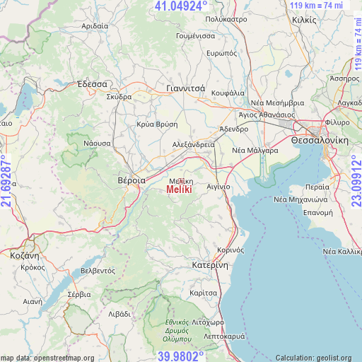
Melíki GPS coordinates[2]
40° 31' 0.66" North, 22° 23' 45.564" East
| Map corner | latitude | longitude |
|---|---|---|
| Upper-left | 41.04924°, | 21.69287° |
| Center: | 40.51685°, | 22.39599° |
| Lower-right: | 39.9802°, | 23.09912° |
| Map W x H: | 118.9×118.9 km | = 73.9×73.9mi |
| max Lat: | 41.72048° ⇑24.6% North |
| Melíki: | 40.51685° |
| min Lat: | ⇓75.4% South 34.8346° |
| min Long | Melíki | max Long |
| 19.40494° | 22.39599° | 29.59361° |
| W 37.2%⇐ | ⇒62.8% E |
Elevation
Elevation of Melíki is 34 m = 112 ft, and this is 134.9 m = 443 ft below average elevation for this country.
| Max E: |
1439 m = 4721 ft | 68.3% |
| Avg. | 168.9 m = 554 ft | |
| Melíki | 34 m = 112 ft | |
Min E: |
0 m = 0 ft | 31.7% |
See also: Greece elevation on elevation.city.
Geographical zone
Melíki is located in North temperate zone (between Tropic of Cancer and the Arctic Circle). Distance of this Northern Tropic circle is 1899.1 km =1180 mi to South.| Distance of | km | miles | from Melíki |
|---|---|---|---|
| North Pole | 5502 | 3418.8 | to North |
| Arctic Circle | 2896.1 | 1799.6 | to North |
| Tropic Cancer | 1899.1 | 1180 | to South |
| Equator | 4505.1 | 2799.3 | to South |


Nearby cities:
15 places around Melíki: (largest is in red/bold)
• Agkathiá
7.6 km =4.7 mi,  55°
55°
• Episkopí
8.7 km =5.4 mi,  342°
342°
• Kampochóri
10.5 km =6.5 mi,  347°
347°
• Kavásila
9.9 km =6.2 mi,  326°
326°
• Kefalochóri
6.3 km =3.9 mi, 336°
• Kolindrós
8.5 km =5.3 mi,  119°
119°
• Kouloúra
7.4 km =4.6 mi,  296°
296°
• Kypséli
9.3 km =5.8 mi, 62°
• Loutrós
8 km =5 mi,  2°
2°
• Neókastro
2.1 km =1.3 mi,  128°
128°
• Niséli
10.2 km =6.3 mi,  32°
32°
• Palatítsia
5.8 km =3.6 mi,  230°
230°
• Pródromos
3.8 km =2.4 mi, 0°
• Vergína
7.5 km =4.7 mi,  243°
243°
• Xechasméni
7.5 km =4.7 mi,  320°
320°
Sources, notices
• [Note1] Compared only with cities in Greece existing in our database
• [Src1] Map data: © OpenStreetMap contributors (CC-BY-SA)
• [Src2] Other city data from geonames.org with taken over terms of usage.
• [Src3] Geographical zone / Annual Mean Temperature by Robert A. Rohde @ Wikipedia
