Umatac Village geodata
Umatac Village (Umatac) is a seat of a first-order administrative division; located in Guam in Pacific/Guam (GMT+10) time zone. With population of 903 people, there are 20 cities with bigger population in this country. Compared to other cities in Guam, 90.5% of cities are located further ↑North; 95.2% of cities are located further →East and 85.7% of cities have higher elevation than Umatac Village. Note1


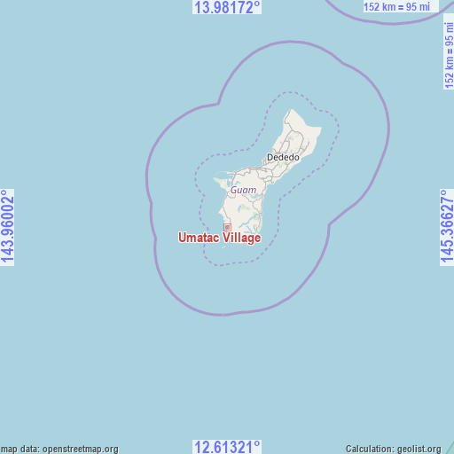
Umatac Village GPS coordinates[2]
13° 17' 54.348" North, 144° 39' 47.304" East
| Map corner | latitude | longitude |
|---|---|---|
| Upper-left | 13.98172°, | 143.96002° |
| Center: | 13.29843°, | 144.66314° |
| Lower-right: | 12.61321°, | 145.36627° |
| Map W x H: | 152.2×152.2 km | = 94.6×94.6mi |
| max Lat: | 13.53605° ⇑90.5% North |
| Umatac Village: | 13.29843° |
| min Lat: | ⇓9.5% South 13.26584° |
| min Long | Umatac Village | max Long |
| 144.65852° | 144.66314° | 144.88855° |
| W 4.8%⇐ | ⇒95.2% E |
Elevation
Elevation of Umatac Village is 6 m = 20 ft, and this is 37.2 m = 122 ft below average elevation for this country.
| Max E: |
132 m = 433 ft | 85.7% |
| Avg. | 43.2 m = 142 ft | |
| Umatac Village | 6 m = 20 ft | |
Min E: |
0 m = 0 ft | 14.3% |
See also: Guam elevation on elevation.city.
Geographical zone
Umatac Village is located in North Torrid zone (between Equator and Tropic of Cancer). Distance of this Northern Tropic circle is 1127.3 km =700.5 mi to North.| Distance of | km | miles | from Umatac Village |
|---|---|---|---|
| North Pole | 8528.4 | 5299.3 | to North |
| Arctic Circle | 5922.5 | 3680.1 | to North |
| Tropic Cancer | 1127.3 | 700.5 | to North |
| Equator | 1478.6 | 918.8 | to South |


Nearby cities:
15 places around Umatac Village: (largest is in red/bold)
• Agana Heights Village
20.7 km =12.9 mi,  26°
26°
• Agat Village
10 km =6.2 mi,  357°
357°
• Asan-Maina Village
20.2 km =12.6 mi,  16°
16°
• Chalan Pago-Ordot Village
19.5 km =12.1 mi, 32°
• Guam Government House
21.4 km =13.3 mi, 25°
• Hagåtña
21.8 km =13.5 mi, 25°
• Hagåtña Village
21.9 km =13.6 mi, 27°
• Inarajan Village
9.6 km =6 mi,  106°
106°
• Mangilao Village
22.3 km =13.9 mi,  41°
41°
• Merizo Village
3.7 km =2.3 mi,  169°
169°
• Piti Village
18.5 km =11.5 mi,  10°
10°
• Santa Rita Village
9.8 km =6.1 mi, 5°
• Sinajana Village
20.8 km =12.9 mi, 28°
• Talofofo Village
12.1 km =7.5 mi,  58°
58°
• Yona Village
17.5 km =10.9 mi, 44°
Sources, notices
• [Note1] Compared only with cities in Guam existing in our database
• [Src1] Map data: © OpenStreetMap contributors (CC-BY-SA)
• [Src2] Other city data from geonames.org with taken over terms of usage.
• [Src3] Geographical zone / Annual Mean Temperature by Robert A. Rohde @ Wikipedia
