Berlín geodata
Berlín (Santa Bárbara) is a populated place; located in Honduras in America/Tegucigalpa (GMT-6) time zone. With population of 1,050 people, there are 389 cities with bigger population in this country. Compared to other cities in Honduras, 53% of cities are located further ↑North; 82.8% of cities are located further →East and 86.8% of cities have lower elevation than Berlín. Note1


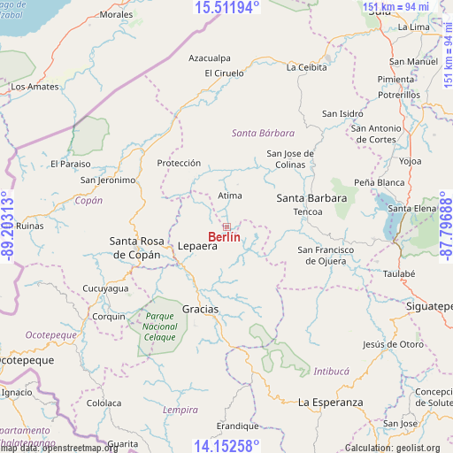
Berlín GPS coordinates[2]
14° 49' 59.988" North, 88° 30' 0" West
| Map corner | latitude | longitude |
|---|---|---|
| Upper-left | 15.51194°, | -89.20313° |
| Center: | 14.83333°, | -88.5° |
| Lower-right: | 14.15258°, | -87.79688° |
| Map W x H: | 151.1×151.1 km | = 93.9×93.9mi |
| max Lat: | 16.45° ⇑53% North |
| Berlín: | 14.83333° |
| min Lat: | ⇓47% South 13.11667° |
| min Long | Berlín | max Long |
| -89.23333° | -88.5° | -83.23333° |
| W 17.2%⇐ | ⇒82.8% E |
Elevation
Elevation of Berlín is 1091 m = 3579 ft, and this is 529.8 m = 1738 ft above average elevation for this country.
| Max E: |
1811 m = 5942 ft | 13.2% |
| Berlín | 1091 m 3579 ft | |
| Avg. | 561.2 m = 1841 ft | |
Min E: |
1 m = 3 ft | 86.8% |
See also: Honduras elevation on elevation.city.
Geographical zone
Berlín is located in North Torrid zone (between Equator and Tropic of Cancer). Distance of this Northern Tropic circle is 956.6 km =594.4 mi to North.| Distance of | km | miles | from Berlín |
|---|---|---|---|
| North Pole | 8357.8 | 5193.3 | to North |
| Arctic Circle | 5751.9 | 3574.1 | to North |
| Tropic Cancer | 956.6 | 594.4 | to North |
| Equator | 1649.3 | 1024.8 | to South |


Nearby cities:
15 places around Berlín: (largest is in red/bold)
• Arada
21.6 km =13.4 mi,  85°
85°
• Atima
11.3 km =7 mi,  9°
9°
• El Níspero
19.4 km =12.1 mi,  112°
112°
• La Laguna del Pedernal
7.4 km =4.6 mi,  255°
255°
• La Libertad
9.7 km =6 mi,  247°
247°
• La Unión
10.9 km =6.8 mi,  99°
99°
• Las Tejeras
11.4 km =7.1 mi, 250°
• Lepaera
10.5 km =6.5 mi,  238°
238°
• Macholoa
23.4 km =14.5 mi,  66°
66°
• Naranjito
23.6 km =14.7 mi,  303°
303°
• Nueva Jalapa
20.2 km =12.6 mi,  62°
62°
• San Juan de Opoa
22.2 km =13.8 mi, 255°
• San Nicolás
22.6 km =14 mi, 60°
• San Vicente Centenario
23.9 km =14.9 mi,  76°
76°
• Taragual
9.4 km =5.8 mi,  169°
169°
Sources, notices
• [Note1] Compared only with cities in Honduras existing in our database
• [Src1] Map data: © OpenStreetMap contributors (CC-BY-SA)
• [Src2] Other city data from geonames.org with taken over terms of usage.
• [Src3] Geographical zone / Annual Mean Temperature by Robert A. Rohde @ Wikipedia
