El Níspero geodata
El Níspero (Santa Bárbara) is a populated place; located in Honduras in America/Tegucigalpa (GMT-6) time zone. With population of 2,474 people, there are 140 cities with bigger population in this country. Compared to other cities in Honduras, 56.6% of cities are located further ↑North; 79.2% of cities are located further →East and 60.8% of cities have lower elevation than El Níspero. Note1


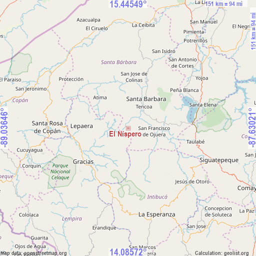
El Níspero GPS coordinates[2]
14° 46' 0.012" North, 88° 19' 59.988" West
| Map corner | latitude | longitude |
|---|---|---|
| Upper-left | 15.44549°, | -89.03646° |
| Center: | 14.76667°, | -88.33333° |
| Lower-right: | 14.08572°, | -87.63021° |
| Map W x H: | 151.2×151.2 km | = 94×94mi |
| max Lat: | 16.45° ⇑56.6% North |
| El Níspero: | 14.76667° |
| min Lat: | ⇓43.4% South 13.11667° |
| min Long | El Níspero | max Long |
| -89.23333° | -88.33333° | -83.23333° |
| W 20.8%⇐ | ⇒79.2% E |
Elevation
Elevation of El Níspero is 686 m = 2251 ft, and this is 124.8 m = 409 ft above average elevation for this country.
| Max E: |
1811 m = 5942 ft | 39.2% |
| El Níspero | 686 m 2251 ft | |
| Avg. | 561.2 m = 1841 ft | |
Min E: |
1 m = 3 ft | 60.8% |
See also: Honduras elevation on elevation.city.
Geographical zone
El Níspero is located in North Torrid zone (between Equator and Tropic of Cancer). Distance of this Northern Tropic circle is 964 km =599 mi to North.| Distance of | km | miles | from El Níspero |
|---|---|---|---|
| North Pole | 8365.2 | 5197.9 | to North |
| Arctic Circle | 5759.3 | 3578.7 | to North |
| Tropic Cancer | 964 | 599 | to North |
| Equator | 1641.9 | 1020.2 | to South |


Nearby cities:
15 places around El Níspero: (largest is in red/bold)
• Arada
9.9 km =6.2 mi,  21°
21°
• Berlín
19.4 km =12.1 mi,  292°
292°
• Ceguaca
14.8 km =9.2 mi,  75°
75°
• Concepción del Sur
18.3 km =11.4 mi, 78°
• Gualjoco
23 km =14.3 mi,  27°
27°
• La Unión
9.1 km =5.7 mi,  307°
307°
• Lagunas
23.2 km =14.4 mi,  224°
224°
• Macholoa
17.1 km =10.6 mi,  12°
12°
• Nueva Jalapa
16.7 km =10.4 mi,  0°
0°
• San Francisco de Ojuera
16.2 km =10.1 mi,  96°
96°
• San Nicolás
18.6 km =11.6 mi, 5°
• San Vicente Centenario
14 km =8.7 mi, 22°
• Santa Bárbara
19.9 km =12.4 mi, 31°
• Santa Rita
20.9 km =13 mi,  36°
36°
• Taragual
16.2 km =10.1 mi,  263°
263°
Sources, notices
• [Note1] Compared only with cities in Honduras existing in our database
• [Src1] Map data: © OpenStreetMap contributors (CC-BY-SA)
• [Src2] Other city data from geonames.org with taken over terms of usage.
• [Src3] Geographical zone / Annual Mean Temperature by Robert A. Rohde @ Wikipedia
