San Vicente Centenario geodata
San Vicente Centenario (Santa Bárbara) is a populated place; located in Honduras in America/Tegucigalpa (GMT-6) time zone. With population of 2,430 people, there are 143 cities with bigger population in this country. Compared to other cities in Honduras, 50.2% of cities are located further ↑North; 77% of cities are located further →East and 65.6% of cities have higher elevation than San Vicente Centenario. Note1


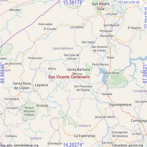
San Vicente Centenario GPS coordinates[2]
14° 52' 59.988" North, 88° 16' 59.988" West
| Map corner | latitude | longitude |
|---|---|---|
| Upper-left | 15.56178°, | -88.98646° |
| Center: | 14.88333°, | -88.28333° |
| Lower-right: | 14.20274°, | -87.58021° |
| Map W x H: | 151.1×151.1 km | = 93.9×93.9mi |
| max Lat: | 16.45° ⇑50.2% North |
| San Vicente Centenario: | 14.88333° |
| min Lat: | ⇓49.8% South 13.11667° |
| min Long | San Vicente Cen | max Long |
| -89.23333° | -88.28333° | -83.23333° |
| W 23%⇐ | ⇒77% E |
Elevation
Elevation of San Vicente Centenario is 302 m = 991 ft, and this is 259.2 m = 850 ft below average elevation for this country.
| Max E: |
1811 m = 5942 ft | 65.6% |
| Avg. | 561.2 m = 1841 ft | |
| San Vicente Centenario | 302 m = 991 ft | |
Min E: |
1 m = 3 ft | 34.4% |
See also: Honduras elevation on elevation.city.
Geographical zone
San Vicente Centenario is located in North Torrid zone (between Equator and Tropic of Cancer). Distance of this Northern Tropic circle is 951 km =590.9 mi to North.| Distance of | km | miles | from San Vicente Centenario |
|---|---|---|---|
| North Pole | 8352.2 | 5189.8 | to North |
| Arctic Circle | 5746.3 | 3570.6 | to North |
| Tropic Cancer | 951 | 590.9 | to North |
| Equator | 1654.9 | 1028.3 | to South |


Nearby cities:
15 places around San Vicente Centenario: (largest is in red/bold)
• Arada
4.1 km =2.5 mi,  205°
205°
• Ceguaca
12.9 km =8 mi,  135°
135°
• Concepción del Sur
15.6 km =9.7 mi,  126°
126°
• El Níspero
14 km =8.7 mi,  202°
202°
• Gualjoco
9.2 km =5.7 mi,  35°
35°
• La Unión
14.6 km =9.1 mi,  239°
239°
• Macholoa
4.1 km =2.5 mi,  334°
334°
• Nueva Jalapa
6.5 km =4 mi,  304°
304°
• Nuevo Celilac
12.3 km =7.6 mi, 334°
• San Francisco de Ojuera
18.3 km =11.4 mi, 144°
• San José de Colinas
16.8 km =10.4 mi,  353°
353°
• San Luis de Planes
19.6 km =12.2 mi,  55°
55°
• San Nicolás
6.6 km =4.1 mi, 327°
• Santa Bárbara
6.5 km =4 mi,  51°
51°
• Santa Rita
8.1 km =5 mi, 62°
Sources, notices
• [Note1] Compared only with cities in Honduras existing in our database
• [Src1] Map data: © OpenStreetMap contributors (CC-BY-SA)
• [Src2] Other city data from geonames.org with taken over terms of usage.
• [Src3] Geographical zone / Annual Mean Temperature by Robert A. Rohde @ Wikipedia
