Atima geodata
Atima (Santa Bárbara) is a populated place; located in Honduras in America/Tegucigalpa (GMT-6) time zone. With population of 1,703 people, there are 215 cities with bigger population in this country. Compared to other cities in Honduras, 53.8% of cities are located further ↓South; 82.4% of cities are located further →East and 75% of cities have lower elevation than Atima. Note1


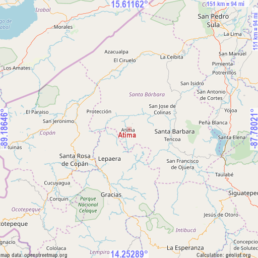
Atima GPS coordinates[2]
14° 55' 59.988" North, 88° 28' 59.988" West
| Map corner | latitude | longitude |
|---|---|---|
| Upper-left | 15.61162°, | -89.18646° |
| Center: | 14.93333°, | -88.48333° |
| Lower-right: | 14.25289°, | -87.78021° |
| Map W x H: | 151.1×151.1 km | = 93.9×93.9mi |
| max Lat: | 16.45° ⇑46.2% North |
| Atima: | 14.93333° |
| min Lat: | ⇓53.8% South 13.11667° |
| min Long | Atima | max Long |
| -89.23333° | -88.48333° | -83.23333° |
| W 17.6%⇐ | ⇒82.4% E |
Elevation
Elevation of Atima is 837 m = 2746 ft, and this is 275.8 m = 905 ft above average elevation for this country.
| Max E: |
1811 m = 5942 ft | 25% |
| Atima | 837 m 2746 ft | |
| Avg. | 561.2 m = 1841 ft | |
Min E: |
1 m = 3 ft | 75% |
See also: Honduras elevation on elevation.city.
Geographical zone
Atima is located in North Torrid zone (between Equator and Tropic of Cancer). Distance of this Northern Tropic circle is 945.5 km =587.5 mi to North.| Distance of | km | miles | from Atima |
|---|---|---|---|
| North Pole | 8346.6 | 5186.3 | to North |
| Arctic Circle | 5740.7 | 3567.1 | to North |
| Tropic Cancer | 945.5 | 587.5 | to North |
| Equator | 1660.4 | 1031.7 | to South |


Nearby cities:
15 places around Atima: (largest is in red/bold)
• Berlín
11.3 km =7 mi,  189°
189°
• El Corozal
20.6 km =12.8 mi,  315°
315°
• La Laguna del Pedernal
15.8 km =9.8 mi,  214°
214°
• La Libertad
18.3 km =11.4 mi,  215°
215°
• La Unión
15.8 km =9.8 mi,  145°
145°
• Las Tejeras
19.4 km =12.1 mi, 220°
• Lepaera
19.8 km =12.3 mi, 212°
• Macholoa
19.8 km =12.3 mi,  95°
95°
• Naranjito
21.6 km =13.4 mi,  274°
274°
• Nueva Jalapa
16.2 km =10.1 mi, 96°
• Nuevo Celilac
17 km =10.6 mi,  70°
70°
• Protección
21.1 km =13.1 mi,  301°
301°
• San Luis
19.8 km =12.3 mi,  32°
32°
• San Nicolás
17.9 km =11.1 mi,  90°
90°
• Taragual
20.4 km =12.7 mi,  180°
180°
Sources, notices
• [Note1] Compared only with cities in Honduras existing in our database
• [Src1] Map data: © OpenStreetMap contributors (CC-BY-SA)
• [Src2] Other city data from geonames.org with taken over terms of usage.
• [Src3] Geographical zone / Annual Mean Temperature by Robert A. Rohde @ Wikipedia
