Vrsar geodata
Vrsar (Istria) is a seat of a second-order administrative division; located in Croatia in Europe/Zagreb (GMT+2) time zone. With population of 1,881 people, there are 227 cities with bigger population in this country. Compared to other cities in Croatia, 71.2% of cities are located further ↑North; 99.5% of cities are located further →East and 92.6% of cities have higher elevation than Vrsar. Note1


Vrsar GPS coordinates[2]
45° 8' 57.012" North, 13° 36' 19.008" East
| Map corner | latitude | longitude |
|---|---|---|
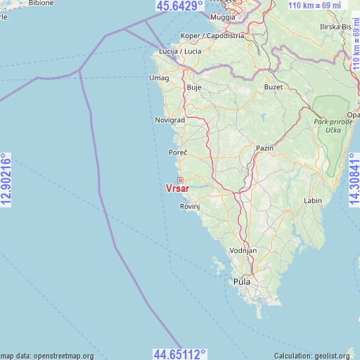
| Upper-left | 45.6429°, | 12.90216° |
| Center: | 45.14917°, | 13.60528° |
| Lower-right: | 44.65112°, | 14.30841° |
| Map W x H: | 110.3×110.3 km | = 68.5×68.5mi |
| max Lat: | 46.52694° ⇑71.2% North |
| Vrsar: | 45.14917° |
| min Lat: | ⇓28.8% South 42.54972° |
| min Long | Vrsar | max Long |
| 13.52389° | 13.60528° | 19.37694° |
| W 0.5%⇐ | ⇒99.5% E |
Elevation
Elevation of Vrsar is 15 m = 49 ft, and this is 138.3 m = 454 ft below average elevation for this country.
| Max E: |
827 m = 2713 ft | 92.6% |
| Avg. | 153.3 m = 503 ft | |
| Vrsar | 15 m = 49 ft | |
Min E: |
-1 m = -3 ft | 7.4% |
See also: Croatia elevation on elevation.city.
Geographical zone
Vrsar is located in North temperate zone (between Tropic of Cancer and the Arctic Circle). Distance of this North polar circle is 2381.1 km =1479.5 mi to North.| Distance of | km | miles | from Vrsar |
|---|---|---|---|
| North Pole | 4986.9 | 3098.7 | to North |
| Arctic Circle | 2381.1 | 1479.5 | to North |
| Tropic Cancer | 2414.2 | 1500.1 | to South |
| Equator | 5020.1 | 3119.3 | to South |


Nearby cities:
15 places around Vrsar: (largest is in red/bold)
• Bale
18.5 km =11.5 mi,  130°
130°
• Funtana
2.8 km =1.7 mi,  359°
359°
• Kanfanar
18.6 km =11.6 mi,  99°
99°
• Kaštelir
18.3 km =11.4 mi,  20°
20°
• Novigrad
18.8 km =11.7 mi,  348°
348°
• Poreč
8.5 km =5.3 mi, 354°
• Rovinj
8.2 km =5.1 mi,  160°
160°
• Sveti Lovreč Pazenatički
11.1 km =6.9 mi,  74°
74°
• Sveti Petar u Šumi
21 km =13 mi,  79°
79°
• Svetvinčenat
22.9 km =14.2 mi,  107°
107°
• Tar
16.9 km =10.5 mi,  5°
5°
• Tinjan
19.9 km =12.4 mi, 67°
• Visignano
16.8 km =10.4 mi,  32°
32°
• Vrvari
8.7 km =5.4 mi, 15°
• Červar-Porat
13.7 km =8.5 mi, 357°
Sources, notices
• [Note1] Compared only with cities in Croatia existing in our database
• [Src1] Map data: © OpenStreetMap contributors (CC-BY-SA)
• [Src2] Other city data from geonames.org with taken over terms of usage.
• [Src3] Geographical zone / Annual Mean Temperature by Robert A. Rohde @ Wikipedia
