Virje geodata
Virje (Koprivničko-Križevačka) is a seat of a second-order administrative division; located in Croatia in Europe/Zagreb (GMT+2) time zone. With population of 3,702 people, there are 108 cities with bigger population in this country. Compared to other cities in Croatia, 83.8% of cities are located further ↓South; 68.1% of cities are located further ←West and 55.4% of cities have lower elevation than Virje. Note1


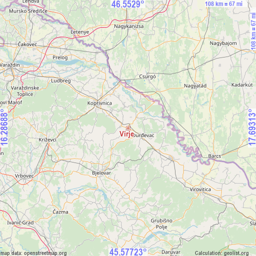
Virje GPS coordinates[2]
46° 4' 1.992" North, 16° 59' 24" East
| Map corner | latitude | longitude |
|---|---|---|
| Upper-left | 46.5529°, | 16.28688° |
| Center: | 46.06722°, | 16.99° |
| Lower-right: | 45.57723°, | 17.69313° |
| Map W x H: | 108.5×108.5 km | = 67.4×67.4mi |
| max Lat: | 46.52694° ⇑16.2% North |
| Virje: | 46.06722° |
| min Lat: | ⇓83.8% South 42.54972° |
| min Long | Virje | max Long |
| 13.52389° | 16.99° | 19.37694° |
| W 68.1%⇐ | ⇒31.9% E |
Elevation
Elevation of Virje is 136 m = 446 ft, and this is 17.3 m = 57 ft below average elevation for this country.
| Max E: |
827 m = 2713 ft | 44.6% |
| Avg. | 153.3 m = 503 ft | |
| Virje | 136 m = 446 ft | |
Min E: |
-1 m = -3 ft | 55.4% |
See also: Croatia elevation on elevation.city.
Geographical zone
Virje is located in North temperate zone (between Tropic of Cancer and the Arctic Circle). Distance of this North polar circle is 2279 km =1416.1 mi to North.| Distance of | km | miles | from Virje |
|---|---|---|---|
| North Pole | 4884.9 | 3035.3 | to North |
| Arctic Circle | 2279 | 1416.1 | to North |
| Tropic Cancer | 2516.3 | 1563.6 | to South |
| Equator | 5122.2 | 3182.8 | to South |


Nearby cities:
15 places around Virje: (largest is in red/bold)
• Budančevica
15.5 km =9.6 mi,  127°
127°
• Glogovac
10.4 km =6.5 mi,  301°
301°
• Gola
15.2 km =9.4 mi,  20°
20°
• Herešin
15.6 km =9.7 mi,  323°
323°
• Hlebine
10.2 km =6.3 mi,  348°
348°
• Kalinovac
10.6 km =6.6 mi,  113°
113°
• Kapela
13.8 km =8.6 mi,  230°
230°
• Koprivnički Bregi
10.3 km =6.4 mi, 320°
• Molve
5.7 km =3.5 mi,  34°
34°
• Novigrad Podravski
3 km =1.9 mi,  293°
293°
• Novo Virje
12.8 km =8 mi,  77°
77°
• Prugovac
14.7 km =9.1 mi,  136°
136°
• Sigetec
14.1 km =8.8 mi,  342°
342°
• Veliko Trojstvo
15.3 km =9.5 mi,  196°
196°
• Đurđevac
6.8 km =4.2 mi,  115°
115°
Sources, notices
• [Note1] Compared only with cities in Croatia existing in our database
• [Src1] Map data: © OpenStreetMap contributors (CC-BY-SA)
• [Src2] Other city data from geonames.org with taken over terms of usage.
• [Src3] Geographical zone / Annual Mean Temperature by Robert A. Rohde @ Wikipedia
