Hlebine geodata
Hlebine (Koprivničko-Križevačka) is a seat of a second-order administrative division; located in Croatia in Europe/Zagreb (GMT+2) time zone. With population of 1,297 people, there are 344 cities with bigger population in this country. Compared to other cities in Croatia, 86.6% of cities are located further ↓South; 67.7% of cities are located further ←West and 52.3% of cities have higher elevation than Hlebine. Note1


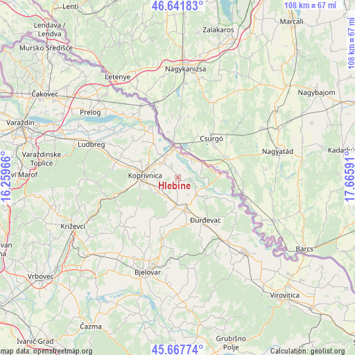
Hlebine GPS coordinates[2]
46° 9' 24.984" North, 16° 57' 46.008" East
| Map corner | latitude | longitude |
|---|---|---|
| Upper-left | 46.64183°, | 16.25966° |
| Center: | 46.15694°, | 16.96278° |
| Lower-right: | 45.66774°, | 17.66591° |
| Map W x H: | 108.3×108.3 km | = 67.3×67.3mi |
| max Lat: | 46.52694° ⇑13.4% North |
| Hlebine: | 46.15694° |
| min Lat: | ⇓86.6% South 42.54972° |
| min Long | Hlebine | max Long |
| 13.52389° | 16.96278° | 19.37694° |
| W 67.7%⇐ | ⇒32.3% E |
Elevation
Elevation of Hlebine is 122 m = 400 ft, and this is 31.3 m = 103 ft below average elevation for this country.
| Max E: |
827 m = 2713 ft | 52.3% |
| Avg. | 153.3 m = 503 ft | |
| Hlebine | 122 m = 400 ft | |
Min E: |
-1 m = -3 ft | 47.7% |
See also: Croatia elevation on elevation.city.
Geographical zone
Hlebine is located in North temperate zone (between Tropic of Cancer and the Arctic Circle). Distance of this North polar circle is 2269 km =1409.9 mi to North.| Distance of | km | miles | from Hlebine |
|---|---|---|---|
| North Pole | 4874.9 | 3029.1 | to North |
| Arctic Circle | 2269 | 1409.9 | to North |
| Tropic Cancer | 2526.3 | 1569.8 | to South |
| Equator | 5132.2 | 3189 | to South |


Nearby cities:
15 places around Hlebine: (largest is in red/bold)
• Drnje
6.6 km =4.1 mi,  327°
327°
• Glogovac
8.2 km =5.1 mi,  235°
235°
• Gola
8.5 km =5.3 mi,  59°
59°
• Herešin
7.7 km =4.8 mi,  289°
289°
• Koprivnica
10.4 km =6.5 mi,  273°
273°
• Koprivnički Bregi
4.8 km =3 mi,  245°
245°
• Koprivnički Ivanec
12.3 km =7.6 mi, 294°
• Molve
7.5 km =4.7 mi,  135°
135°
• Novigrad Podravski
8.8 km =5.5 mi,  184°
184°
• Peteranec
6.7 km =4.2 mi,  305°
305°
• Sigetec
4.1 km =2.5 mi, 329°
• Torčec
9.5 km =5.9 mi,  320°
320°
• Virje
10.2 km =6.3 mi,  168°
168°
• Ðelekovec
12.6 km =7.8 mi, 324°
• Ždala
14.1 km =8.8 mi,  85°
85°
Sources, notices
• [Note1] Compared only with cities in Croatia existing in our database
• [Src1] Map data: © OpenStreetMap contributors (CC-BY-SA)
• [Src2] Other city data from geonames.org with taken over terms of usage.
• [Src3] Geographical zone / Annual Mean Temperature by Robert A. Rohde @ Wikipedia
