Trnava geodata
Trnava (Osječko-Baranjska) is a seat of a second-order administrative division; located in Croatia in Europe/Zagreb (GMT+2) time zone. In our database, there are 904 cities with bigger population. Compared to other cities in Croatia, 62.6% of cities are located further ↑North; 85.9% of cities are located further ←West and 54.3% of cities have lower elevation than Trnava. Note1


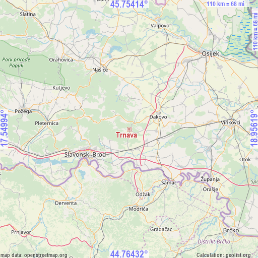
Trnava GPS coordinates[2]
45° 15' 41.004" North, 18° 15' 11.016" East
| Map corner | latitude | longitude |
|---|---|---|
| Upper-left | 45.75414°, | 17.54994° |
| Center: | 45.26139°, | 18.25306° |
| Lower-right: | 44.76432°, | 18.95619° |
| Map W x H: | 110.1×110.1 km | = 68.4×68.4mi |
| max Lat: | 46.52694° ⇑62.6% North |
| Trnava: | 45.26139° |
| min Lat: | ⇓37.4% South 42.54972° |
| min Long | Trnava | max Long |
| 13.52389° | 18.25306° | 19.37694° |
| W 85.9%⇐ | ⇒14.1% E |
Elevation
Elevation of Trnava is 134 m = 440 ft, and this is 19.3 m = 63 ft below average elevation for this country.
| Max E: |
827 m = 2713 ft | 45.7% |
| Avg. | 153.3 m = 503 ft | |
| Trnava | 134 m = 440 ft | |
Min E: |
-1 m = -3 ft | 54.3% |
See also: Croatia elevation on elevation.city.
Geographical zone
Trnava is located in North temperate zone (between Tropic of Cancer and the Arctic Circle). Distance of this North polar circle is 2368.6 km =1471.8 mi to North.| Distance of | km | miles | from Trnava |
|---|---|---|---|
| North Pole | 4974.5 | 3091 | to North |
| Arctic Circle | 2368.6 | 1471.8 | to North |
| Tropic Cancer | 2426.7 | 1507.9 | to South |
| Equator | 5032.6 | 3127.1 | to South |


Nearby cities:
15 places around Trnava: (largest is in red/bold)
• Bicko Selo
11.6 km =7.2 mi,  204°
204°
• Donji Andrijevci
8.9 km =5.5 mi,  155°
155°
• Garčin
10.3 km =6.4 mi,  212°
212°
• Gašinci
9.5 km =5.9 mi,  31°
31°
• Klokočevik
9.3 km =5.8 mi,  240°
240°
• Korenica
8 km =5 mi, 239°
• Levanjska Varoš
8.1 km =5 mi,  317°
317°
• Oprisavci
12.4 km =7.7 mi,  188°
188°
• Piškorevci
11.8 km =7.3 mi,  93°
93°
• Sapci
9.8 km =6.1 mi, 201°
• Stari Perkovci
8.9 km =5.5 mi,  123°
123°
• Staro Topolje
7.9 km =4.9 mi,  182°
182°
• Trnjani
12 km =7.5 mi,  226°
226°
• Vrpolje
13.2 km =8.2 mi, 115°
• Čajkovci
11.4 km =7.1 mi,  130°
130°
Sources, notices
• [Note1] Compared only with cities in Croatia existing in our database
• [Src1] Map data: © OpenStreetMap contributors (CC-BY-SA)
• [Src2] Other city data from geonames.org with taken over terms of usage.
• [Src3] Geographical zone / Annual Mean Temperature by Robert A. Rohde @ Wikipedia
