Staro Topolje geodata
Staro Topolje (Slavonski Brod-Posavina) is a populated place; located in Croatia in Europe/Zagreb (GMT+2) time zone. With population of 736 people, there are 637 cities with bigger population in this country. Compared to other cities in Croatia, 67.5% of cities are located further ↑North; 85.8% of cities are located further ←West and 80.6% of cities have higher elevation than Staro Topolje. Note1


Staro Topolje GPS coordinates[2]
45° 11' 24" North, 18° 14' 52.008" East
| Map corner | latitude | longitude |
|---|---|---|
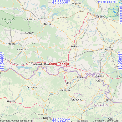
| Upper-left | 45.68338°, | 17.54466° |
| Center: | 45.19°, | 18.24778° |
| Lower-right: | 44.69231°, | 18.95091° |
| Map W x H: | 110.2×110.2 km | = 68.5×68.5mi |
| max Lat: | 46.52694° ⇑67.5% North |
| Staro Topolje: | 45.19° |
| min Lat: | ⇓32.5% South 42.54972° |
| min Long | Staro Topolje | max Long |
| 13.52389° | 18.24778° | 19.37694° |
| W 85.8%⇐ | ⇒14.2% E |
Elevation
Elevation of Staro Topolje is 85 m = 279 ft, and this is 68.3 m = 224 ft below average elevation for this country.
| Max E: |
827 m = 2713 ft | 80.6% |
| Avg. | 153.3 m = 503 ft | |
| Staro Topolje | 85 m = 279 ft | |
Min E: |
-1 m = -3 ft | 19.4% |
See also: Croatia elevation on elevation.city.
Geographical zone
Staro Topolje is located in North temperate zone (between Tropic of Cancer and the Arctic Circle). Distance of this North polar circle is 2376.5 km =1476.7 mi to North.| Distance of | km | miles | from Staro Topolje |
|---|---|---|---|
| North Pole | 4982.4 | 3095.9 | to North |
| Arctic Circle | 2376.5 | 1476.7 | to North |
| Tropic Cancer | 2418.7 | 1502.9 | to South |
| Equator | 5024.7 | 3122.2 | to South |


Nearby cities:
15 places around Staro Topolje: (largest is in red/bold)
• Bicko Selo
5.1 km =3.2 mi,  239°
239°
• Donja Vrba
11.4 km =7.1 mi,  256°
256°
• Donji Andrijevci
4.1 km =2.5 mi,  92°
92°
• Garčin
5.1 km =3.2 mi, 261°
• Klokočevik
8.3 km =5.2 mi,  293°
293°
• Korenica
7.5 km =4.7 mi,  300°
300°
• Oprisavci
4.6 km =2.9 mi,  198°
198°
• Sapci
3.4 km =2.1 mi,  249°
249°
• Stari Perkovci
8.5 km =5.3 mi,  68°
68°
• Trnava
7.9 km =4.9 mi,  2°
2°
• Trnjani
8.3 km =5.2 mi,  268°
268°
• Velika Kopanica
12 km =7.5 mi,  108°
108°
• Vranovci
12.3 km =7.6 mi, 266°
• Zadubravlje
7.9 km =4.9 mi, 248°
• Čajkovci
9.2 km =5.7 mi, 86°
Sources, notices
• [Note1] Compared only with cities in Croatia existing in our database
• [Src1] Map data: © OpenStreetMap contributors (CC-BY-SA)
• [Src2] Other city data from geonames.org with taken over terms of usage.
• [Src3] Geographical zone / Annual Mean Temperature by Robert A. Rohde @ Wikipedia
