Rakitje geodata
Rakitje (Zagrebačka) is a populated place; located in Croatia in Europe/Zagreb (GMT+2) time zone. With population of 2,301 people, there are 183 cities with bigger population in this country. Compared to other cities in Croatia, 71.3% of cities are located further ↓South; 74.5% of cities are located further →East and 54.9% of cities have lower elevation than Rakitje. Note1


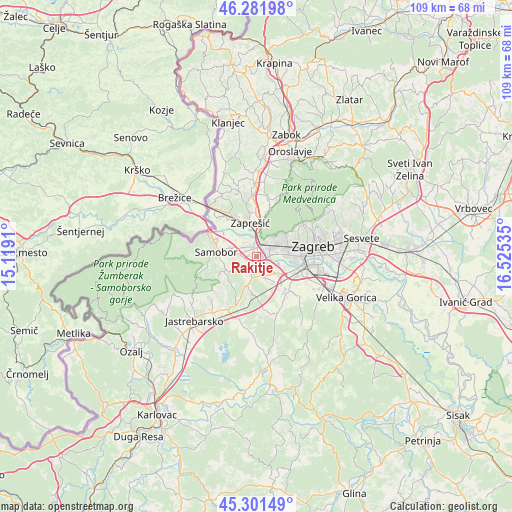
Rakitje GPS coordinates[2]
45° 47' 38.004" North, 15° 49' 19.992" East
| Map corner | latitude | longitude |
|---|---|---|
| Upper-left | 46.28198°, | 15.1191° |
| Center: | 45.79389°, | 15.82222° |
| Lower-right: | 45.30149°, | 16.52535° |
| Map W x H: | 109×109 km | = 67.7×67.7mi |
| max Lat: | 46.52694° ⇑28.7% North |
| Rakitje: | 45.79389° |
| min Lat: | ⇓71.3% South 42.54972° |
| min Long | Rakitje | max Long |
| 13.52389° | 15.82222° | 19.37694° |
| W 25.5%⇐ | ⇒74.5% E |
Elevation
Elevation of Rakitje is 135 m = 443 ft, and this is 18.3 m = 60 ft below average elevation for this country.
| Max E: |
827 m = 2713 ft | 45.1% |
| Avg. | 153.3 m = 503 ft | |
| Rakitje | 135 m = 443 ft | |
Min E: |
-1 m = -3 ft | 54.9% |
See also: Croatia elevation on elevation.city.
Geographical zone
Rakitje is located in North temperate zone (between Tropic of Cancer and the Arctic Circle). Distance of this North polar circle is 2309.4 km =1435 mi to North.| Distance of | km | miles | from Rakitje |
|---|---|---|---|
| North Pole | 4915.3 | 3054.2 | to North |
| Arctic Circle | 2309.4 | 1435 | to North |
| Tropic Cancer | 2485.9 | 1544.7 | to South |
| Equator | 5091.8 | 3163.9 | to South |


Nearby cities:
15 places around Rakitje: (largest is in red/bold)
• Bestovje
1.7 km =1.1 mi,  344°
344°
• Domaslovec
5.6 km =3.5 mi,  286°
286°
• Donji Stupnik
6.7 km =4.2 mi,  154°
154°
• Ivanec Bistranski
5.9 km =3.7 mi,  6°
6°
• Jankomir
6 km =3.7 mi,  92°
92°
• Ježdovec
2.5 km =1.6 mi,  118°
118°
• Kerestinec
2.8 km =1.7 mi,  201°
201°
• Kladje
7 km =4.3 mi,  260°
260°
• Lučko
5.2 km =3.2 mi,  134°
134°
• Mala Gorica
4.3 km =2.7 mi,  224°
224°
• Molvice
5.7 km =3.5 mi,  240°
240°
• Orešje
2.9 km =1.8 mi,  328°
328°
• Rakov Potok
6.5 km =4 mi, 197°
• Stenjevec
4.9 km =3 mi,  70°
70°
• Sveta Nedjelja
3.3 km =2.1 mi,  278°
278°
Sources, notices
• [Note1] Compared only with cities in Croatia existing in our database
• [Src1] Map data: © OpenStreetMap contributors (CC-BY-SA)
• [Src2] Other city data from geonames.org with taken over terms of usage.
• [Src3] Geographical zone / Annual Mean Temperature by Robert A. Rohde @ Wikipedia
