Kerestinec geodata
Kerestinec (Zagrebačka) is a populated place; located in Croatia in Europe/Zagreb (GMT+2) time zone. With population of 1,433 people, there are 316 cities with bigger population in this country. Compared to other cities in Croatia, 70.1% of cities are located further ↓South; 75% of cities are located further →East and 56.9% of cities have lower elevation than Kerestinec. Note1


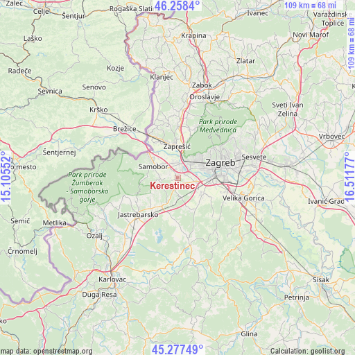
Kerestinec GPS coordinates[2]
45° 46' 12.36" North, 15° 48' 31.104" East
| Map corner | latitude | longitude |
|---|---|---|
| Upper-left | 46.2584°, | 15.10552° |
| Center: | 45.7701°, | 15.80864° |
| Lower-right: | 45.27749°, | 16.51177° |
| Map W x H: | 109.1×109.1 km | = 67.8×67.8mi |
| max Lat: | 46.52694° ⇑29.9% North |
| Kerestinec: | 45.7701° |
| min Lat: | ⇓70.1% South 42.54972° |
| min Long | Kerestinec | max Long |
| 13.52389° | 15.80864° | 19.37694° |
| W 25%⇐ | ⇒75% E |
Elevation
Elevation of Kerestinec is 139 m = 456 ft, and this is 14.3 m = 47 ft below average elevation for this country.
| Max E: |
827 m = 2713 ft | 43.1% |
| Avg. | 153.3 m = 503 ft | |
| Kerestinec | 139 m = 456 ft | |
Min E: |
-1 m = -3 ft | 56.9% |
See also: Croatia elevation on elevation.city.
Geographical zone
Kerestinec is located in North temperate zone (between Tropic of Cancer and the Arctic Circle). Distance of this North polar circle is 2312 km =1436.6 mi to North.| Distance of | km | miles | from Kerestinec |
|---|---|---|---|
| North Pole | 4917.9 | 3055.8 | to North |
| Arctic Circle | 2312 | 1436.6 | to North |
| Tropic Cancer | 2483.2 | 1543 | to South |
| Equator | 5089.2 | 3162.3 | to South |


Nearby cities:
15 places around Kerestinec: (largest is in red/bold)
• Bestovje
4.3 km =2.7 mi,  8°
8°
• Domaslovec
6.1 km =3.8 mi,  314°
314°
• Donji Stupnik
5.2 km =3.2 mi,  130°
130°
• Galgovo
6.1 km =3.8 mi,  228°
228°
• Ježdovec
3.5 km =2.2 mi,  65°
65°
• Kladje
6 km =3.7 mi,  284°
284°
• Lučko
4.9 km =3 mi,  101°
101°
• Mala Gorica
2 km =1.2 mi,  259°
259°
• Molvice
4 km =2.5 mi,  267°
267°
• Orešje
5.1 km =3.2 mi,  354°
354°
• Rakitje
2.8 km =1.7 mi,  21°
21°
• Rakov Potok
3.7 km =2.3 mi,  193°
193°
• Stenjevec
7.1 km =4.4 mi,  53°
53°
• Sveta Nedjelja
3.8 km =2.4 mi,  325°
325°
• Velika Rakovica
7.1 km =4.4 mi, 266°
Sources, notices
• [Note1] Compared only with cities in Croatia existing in our database
• [Src1] Map data: © OpenStreetMap contributors (CC-BY-SA)
• [Src2] Other city data from geonames.org with taken over terms of usage.
• [Src3] Geographical zone / Annual Mean Temperature by Robert A. Rohde @ Wikipedia
