Otok geodata
Otok (Vukovar-Sirmium) is a seat of a second-order administrative division; located in Croatia in Europe/Zagreb (GMT+2) time zone. With population of 5,887 people, there are 68 cities with bigger population in this country. Compared to other cities in Croatia, 71.7% of cities are located further ↑North; 97.2% of cities are located further ←West and 73.8% of cities have higher elevation than Otok. Note1


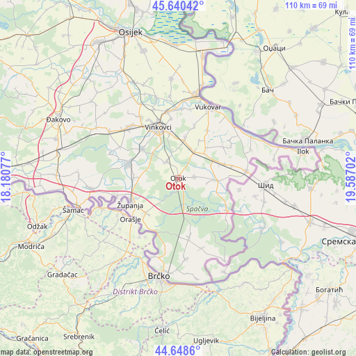
Otok GPS coordinates[2]
45° 8' 48.012" North, 18° 53' 2.004" East
| Map corner | latitude | longitude |
|---|---|---|
| Upper-left | 45.64042°, | 18.18077° |
| Center: | 45.14667°, | 18.88389° |
| Lower-right: | 44.6486°, | 19.58702° |
| Map W x H: | 110.3×110.3 km | = 68.5×68.5mi |
| max Lat: | 46.52694° ⇑71.7% North |
| Otok: | 45.14667° |
| min Lat: | ⇓28.3% South 42.54972° |
| min Long | Otok | max Long |
| 13.52389° | 18.88389° | 19.37694° |
| W 97.2%⇐ | ⇒2.8% E |
Elevation
Elevation of Otok is 90 m = 295 ft, and this is 63.3 m = 208 ft below average elevation for this country.
| Max E: |
827 m = 2713 ft | 73.8% |
| Avg. | 153.3 m = 503 ft | |
| Otok | 90 m = 295 ft | |
Min E: |
-1 m = -3 ft | 26.2% |
See also: Croatia elevation on elevation.city.
Geographical zone
Otok is located in North temperate zone (between Tropic of Cancer and the Arctic Circle). Distance of this North polar circle is 2381.3 km =1479.7 mi to North.| Distance of | km | miles | from Otok |
|---|---|---|---|
| North Pole | 4987.2 | 3098.9 | to North |
| Arctic Circle | 2381.3 | 1479.7 | to North |
| Tropic Cancer | 2413.9 | 1499.9 | to South |
| Equator | 5019.8 | 3119.2 | to South |


Nearby cities:
15 places around Otok: (largest is in red/bold)
• Andrijaševci
14.3 km =8.9 mi,  307°
307°
• Bošnjaci
14.7 km =9.1 mi,  223°
223°
• Cerna
15.7 km =9.8 mi,  284°
284°
• Gradište
13.9 km =8.6 mi,  270°
270°
• Komletinci
5.1 km =3.2 mi,  86°
86°
• Mirkovci
13.9 km =8.6 mi,  349°
349°
• Nijemci
11.9 km =7.4 mi, 93°
• Novi Jankovci
10.4 km =6.5 mi,  5°
5°
• Orolik
11 km =6.8 mi,  46°
46°
• Petrovcy
16.5 km =10.3 mi,  16°
16°
• Privlaka
6.5 km =4 mi,  325°
325°
• Rokovci
14.4 km =8.9 mi, 310°
• Slakovci
10.1 km =6.3 mi,  30°
30°
• Srijemske Laze
10.1 km =6.3 mi, 21°
• Stari Jankovci
13 km =8.1 mi, 10°
Sources, notices
• [Note1] Compared only with cities in Croatia existing in our database
• [Src1] Map data: © OpenStreetMap contributors (CC-BY-SA)
• [Src2] Other city data from geonames.org with taken over terms of usage.
• [Src3] Geographical zone / Annual Mean Temperature by Robert A. Rohde @ Wikipedia
