Slakovci geodata
Slakovci (Vukovar-Sirmium) is a populated place; located in Croatia in Europe/Zagreb (GMT+2) time zone. With population of 958 people, there are 482 cities with bigger population in this country. Compared to other cities in Croatia, 65.3% of cities are located further ↑North; 98.3% of cities are located further ←West and 69.7% of cities have higher elevation than Slakovci. Note1


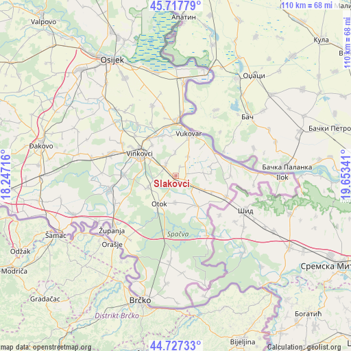
Slakovci GPS coordinates[2]
45° 13' 28.992" North, 18° 57' 1.008" East
| Map corner | latitude | longitude |
|---|---|---|
| Upper-left | 45.71779°, | 18.24716° |
| Center: | 45.22472°, | 18.95028° |
| Lower-right: | 44.72733°, | 19.65341° |
| Map W x H: | 110.1×110.1 km | = 68.4×68.4mi |
| max Lat: | 46.52694° ⇑65.3% North |
| Slakovci: | 45.22472° |
| min Lat: | ⇓34.7% South 42.54972° |
| min Long | Slakovci | max Long |
| 13.52389° | 18.95028° | 19.37694° |
| W 98.3%⇐ | ⇒1.7% E |
Elevation
Elevation of Slakovci is 95 m = 312 ft, and this is 58.3 m = 191 ft below average elevation for this country.
| Max E: |
827 m = 2713 ft | 69.7% |
| Avg. | 153.3 m = 503 ft | |
| Slakovci | 95 m = 312 ft | |
Min E: |
-1 m = -3 ft | 30.3% |
See also: Croatia elevation on elevation.city.
Geographical zone
Slakovci is located in North temperate zone (between Tropic of Cancer and the Arctic Circle). Distance of this North polar circle is 2372.7 km =1474.3 mi to North.| Distance of | km | miles | from Slakovci |
|---|---|---|---|
| North Pole | 4978.5 | 3093.5 | to North |
| Arctic Circle | 2372.7 | 1474.3 | to North |
| Tropic Cancer | 2422.6 | 1505.3 | to South |
| Equator | 5028.5 | 3124.6 | to South |


Nearby cities:
15 places around Slakovci: (largest is in red/bold)
• Bogdanovci
13 km =8.1 mi,  353°
353°
• Cerić
12.1 km =7.5 mi,  322°
322°
• Ilača
12.4 km =7.7 mi,  112°
112°
• Komletinci
8.3 km =5.2 mi,  180°
180°
• Mirkovci
9.2 km =5.7 mi,  302°
302°
• Negoslavci
7.1 km =4.4 mi,  30°
30°
• Nijemci
11.5 km =7.1 mi,  144°
144°
• Novi Jankovci
4.6 km =2.9 mi,  291°
291°
• Orolik
2.9 km =1.8 mi, 111°
• Otok
10.1 km =6.3 mi,  210°
210°
• Petrovcy
7.1 km =4.4 mi,  356°
356°
• Privlaka
9.4 km =5.8 mi,  249°
249°
• Srijemske Laze
1.6 km =1 mi, 294°
• Stari Jankovci
5 km =3.1 mi,  325°
325°
• Tompojevci
11.1 km =6.9 mi,  85°
85°
Sources, notices
• [Note1] Compared only with cities in Croatia existing in our database
• [Src1] Map data: © OpenStreetMap contributors (CC-BY-SA)
• [Src2] Other city data from geonames.org with taken over terms of usage.
• [Src3] Geographical zone / Annual Mean Temperature by Robert A. Rohde @ Wikipedia
