Oštarije geodata
Oštarije (Karlovačka) is a populated place; located in Croatia in Europe/Zagreb (GMT+2) time zone. With population of 1,444 people, there are 313 cities with bigger population in this country. Compared to other cities in Croatia, 65.3% of cities are located further ↑North; 86.5% of cities are located further →East and 91.1% of cities have lower elevation than Oštarije. Note1


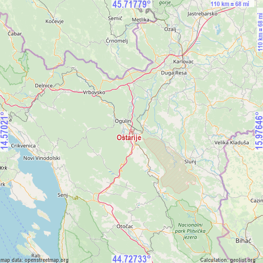
Oštarije GPS coordinates[2]
45° 13' 28.992" North, 15° 16' 23.988" East
| Map corner | latitude | longitude |
|---|---|---|
| Upper-left | 45.71779°, | 14.57021° |
| Center: | 45.22472°, | 15.27333° |
| Lower-right: | 44.72733°, | 15.97646° |
| Map W x H: | 110.1×110.1 km | = 68.4×68.4mi |
| max Lat: | 46.52694° ⇑65.3% North |
| Oštarije: | 45.22472° |
| min Lat: | ⇓34.7% South 42.54972° |
| min Long | Oštarije | max Long |
| 13.52389° | 15.27333° | 19.37694° |
| W 13.5%⇐ | ⇒86.5% E |
Elevation
Elevation of Oštarije is 314 m = 1030 ft, and this is 160.7 m = 527 ft above average elevation for this country.
| Max E: |
827 m = 2713 ft | 8.9% |
| Oštarije | 314 m 1030 ft | |
| Avg. | 153.3 m = 503 ft | |
Min E: |
-1 m = -3 ft | 91.1% |
See also: Croatia elevation on elevation.city.
Geographical zone
Oštarije is located in North temperate zone (between Tropic of Cancer and the Arctic Circle). Distance of this North polar circle is 2372.7 km =1474.3 mi to North.| Distance of | km | miles | from Oštarije |
|---|---|---|---|
| North Pole | 4978.5 | 3093.5 | to North |
| Arctic Circle | 2372.7 | 1474.3 | to North |
| Tropic Cancer | 2422.6 | 1505.3 | to South |
| Equator | 5028.5 | 3124.6 | to South |


Nearby cities:
15 places around Oštarije: (largest is in red/bold)
• Barilović
27.9 km =17.3 mi,  50°
50°
• Bosiljevo
19.7 km =12.2 mi,  3°
3°
• Brinje
27 km =16.8 mi,  203°
203°
• Duga Resa
28.2 km =17.5 mi,  36°
36°
• Generalski Stol
16.2 km =10.1 mi,  32°
32°
• Hreljin Ogulinski
10.8 km =6.7 mi,  318°
318°
• Josipdol
4.5 km =2.8 mi,  166°
166°
• Križpolje
24.2 km =15 mi, 200°
• Krnjak
28.3 km =17.6 mi,  64°
64°
• Ogulin
5.8 km =3.6 mi, 322°
• Plaški
18.1 km =11.2 mi,  155°
155°
• Slunj
27.3 km =17 mi,  116°
116°
• Sveti Petar
8.7 km =5.4 mi, 318°
• Tounj
5.1 km =3.2 mi, 53°
• Vrbovsko
22.1 km =13.7 mi, 316°
Sources, notices
• [Note1] Compared only with cities in Croatia existing in our database
• [Src1] Map data: © OpenStreetMap contributors (CC-BY-SA)
• [Src2] Other city data from geonames.org with taken over terms of usage.
• [Src3] Geographical zone / Annual Mean Temperature by Robert A. Rohde @ Wikipedia
