Plaški geodata
Plaški (Karlovačka) is a seat of a second-order administrative division; located in Croatia in Europe/Zagreb (GMT+2) time zone. With population of 1,580 people, there are 278 cities with bigger population in this country. Compared to other cities in Croatia, 74% of cities are located further ↑North; 85% of cities are located further →East and 94.6% of cities have lower elevation than Plaški. Note1


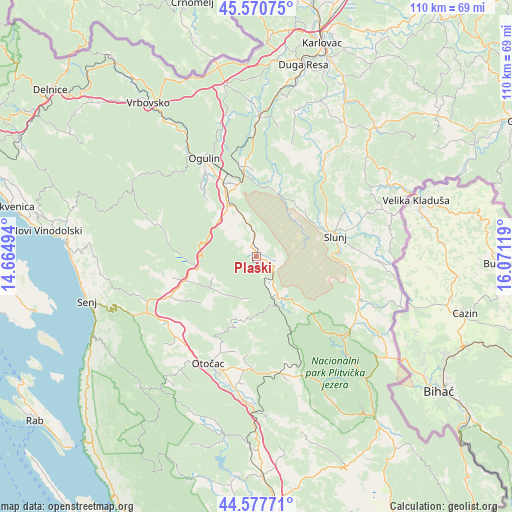
Plaški GPS coordinates[2]
45° 4' 35.004" North, 15° 22' 5.016" East
| Map corner | latitude | longitude |
|---|---|---|
| Upper-left | 45.57075°, | 14.66494° |
| Center: | 45.07639°, | 15.36806° |
| Lower-right: | 44.57771°, | 16.07119° |
| Map W x H: | 110.4×110.4 km | = 68.6×68.6mi |
| max Lat: | 46.52694° ⇑74% North |
| Plaški: | 45.07639° |
| min Lat: | ⇓26% South 42.54972° |
| min Long | Plaški | max Long |
| 13.52389° | 15.36806° | 19.37694° |
| W 15%⇐ | ⇒85% E |
Elevation
Elevation of Plaški is 377 m = 1237 ft, and this is 223.7 m = 734 ft above average elevation for this country.
| Max E: |
827 m = 2713 ft | 5.4% |
| Plaški | 377 m 1237 ft | |
| Avg. | 153.3 m = 503 ft | |
Min E: |
-1 m = -3 ft | 94.6% |
See also: Croatia elevation on elevation.city.
Geographical zone
Plaški is located in North temperate zone (between Tropic of Cancer and the Arctic Circle). Distance of this North polar circle is 2389.1 km =1484.5 mi to North.| Distance of | km | miles | from Plaški |
|---|---|---|---|
| North Pole | 4995 | 3103.7 | to North |
| Arctic Circle | 2389.1 | 1484.5 | to North |
| Tropic Cancer | 2406.1 | 1495.1 | to South |
| Equator | 5012 | 3114.3 | to South |


Nearby cities:
15 places around Plaški: (largest is in red/bold)
• Brinje
20.1 km =12.5 mi,  245°
245°
• Gornji Prozor
27.1 km =16.8 mi,  196°
196°
• Josipdol
13.7 km =8.5 mi,  332°
332°
• Križpolje
17.1 km =10.6 mi, 248°
• Ogulin
23.8 km =14.8 mi, 332°
• Otočac
25.2 km =15.7 mi, 204°
• Oštarije
18.1 km =11.2 mi,  335°
335°
• Rakovica
24 km =14.9 mi,  112°
112°
• Saborsko
13.5 km =8.4 mi,  140°
140°
• Sinac
27.6 km =17.1 mi,  185°
185°
• Slunj
17.5 km =10.9 mi,  75°
75°
• Sveti Petar
26.5 km =16.5 mi, 330°
• Tounj
19.7 km =12.2 mi,  350°
350°
• Vrhovine
25.3 km =15.7 mi,  170°
170°
• Čovići
28.1 km =17.5 mi, 190°
Sources, notices
• [Note1] Compared only with cities in Croatia existing in our database
• [Src1] Map data: © OpenStreetMap contributors (CC-BY-SA)
• [Src2] Other city data from geonames.org with taken over terms of usage.
• [Src3] Geographical zone / Annual Mean Temperature by Robert A. Rohde @ Wikipedia
