Laslovo geodata
Laslovo (Osječko-Baranjska) is a populated place; located in Croatia in Europe/Zagreb (GMT+2) time zone. With population of 1,079 people, there are 420 cities with bigger population in this country. Compared to other cities in Croatia, 50.5% of cities are located further ↑North; 93.9% of cities are located further ←West and 81.6% of cities have higher elevation than Laslovo. Note1


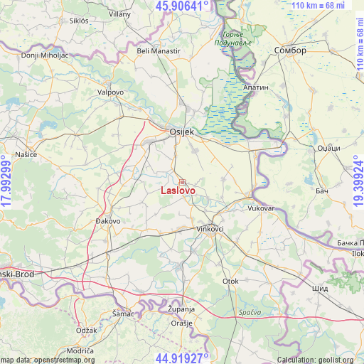
Laslovo GPS coordinates[2]
45° 24' 54" North, 18° 41' 45.996" East
| Map corner | latitude | longitude |
|---|---|---|
| Upper-left | 45.90641°, | 17.99299° |
| Center: | 45.415°, | 18.69611° |
| Lower-right: | 44.91927°, | 19.39924° |
| Map W x H: | 109.8×109.8 km | = 68.2×68.2mi |
| max Lat: | 46.52694° ⇑50.5% North |
| Laslovo: | 45.415° |
| min Lat: | ⇓49.5% South 42.54972° |
| min Long | Laslovo | max Long |
| 13.52389° | 18.69611° | 19.37694° |
| W 93.9%⇐ | ⇒6.1% E |
Elevation
Elevation of Laslovo is 84 m = 276 ft, and this is 69.3 m = 227 ft below average elevation for this country.
| Max E: |
827 m = 2713 ft | 81.6% |
| Avg. | 153.3 m = 503 ft | |
| Laslovo | 84 m = 276 ft | |
Min E: |
-1 m = -3 ft | 18.4% |
See also: Croatia elevation on elevation.city.
Geographical zone
Laslovo is located in North temperate zone (between Tropic of Cancer and the Arctic Circle). Distance of this North polar circle is 2351.5 km =1461.2 mi to North.| Distance of | km | miles | from Laslovo |
|---|---|---|---|
| North Pole | 4957.4 | 3080.4 | to North |
| Arctic Circle | 2351.5 | 1461.2 | to North |
| Tropic Cancer | 2443.8 | 1518.5 | to South |
| Equator | 5049.7 | 3137.7 | to South |


Nearby cities:
15 places around Laslovo: (largest is in red/bold)
• Antin
5.7 km =3.5 mi,  130°
130°
• Antunovac
8.6 km =5.3 mi,  348°
348°
• Bobota
12.3 km =7.6 mi,  86°
86°
• Brijest
11.9 km =7.4 mi, 350°
• Ernestinovo
5 km =3.1 mi,  324°
324°
• Gaboš
7.6 km =4.7 mi,  155°
155°
• Jarmina
11.1 km =6.9 mi,  166°
166°
• Koritna
10.7 km =6.6 mi,  251°
251°
• Markušica
4.6 km =2.9 mi, 170°
• Mrzović
12.7 km =7.9 mi,  219°
219°
• Ostrovo
11 km =6.8 mi,  138°
138°
• Tenja
10.1 km =6.3 mi,  23°
23°
• Tordinci
9.2 km =5.7 mi,  122°
122°
• Vladislavci
10.7 km =6.6 mi,  297°
297°
• Šodolovci
6.1 km =3.8 mi, 254°
Sources, notices
• [Note1] Compared only with cities in Croatia existing in our database
• [Src1] Map data: © OpenStreetMap contributors (CC-BY-SA)
• [Src2] Other city data from geonames.org with taken over terms of usage.
• [Src3] Geographical zone / Annual Mean Temperature by Robert A. Rohde @ Wikipedia
