Antunovac geodata
Antunovac (Osječko-Baranjska) is a seat of a second-order administrative division; located in Croatia in Europe/Zagreb (GMT+2) time zone. With population of 2,294 people, there are 184 cities with bigger population in this country. Compared to other cities in Croatia, 52.6% of cities are located further ↓South; 93.2% of cities are located further ←West and 79.3% of cities have higher elevation than Antunovac. Note1


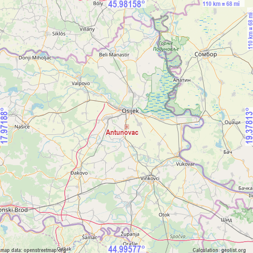
Antunovac GPS coordinates[2]
45° 29' 26.988" North, 18° 40' 30" East
| Map corner | latitude | longitude |
|---|---|---|
| Upper-left | 45.98158°, | 17.97188° |
| Center: | 45.49083°, | 18.675° |
| Lower-right: | 44.99577°, | 19.37813° |
| Map W x H: | 109.6×109.6 km | = 68.1×68.1mi |
| max Lat: | 46.52694° ⇑47.4% North |
| Antunovac: | 45.49083° |
| min Lat: | ⇓52.6% South 42.54972° |
| min Long | Antunovac | max Long |
| 13.52389° | 18.675° | 19.37694° |
| W 93.2%⇐ | ⇒6.8% E |
Elevation
Elevation of Antunovac is 86 m = 282 ft, and this is 67.3 m = 221 ft below average elevation for this country.
| Max E: |
827 m = 2713 ft | 79.3% |
| Avg. | 153.3 m = 503 ft | |
| Antunovac | 86 m = 282 ft | |
Min E: |
-1 m = -3 ft | 20.7% |
See also: Croatia elevation on elevation.city.
Geographical zone
Antunovac is located in North temperate zone (between Tropic of Cancer and the Arctic Circle). Distance of this North polar circle is 2343.1 km =1455.9 mi to North.| Distance of | km | miles | from Antunovac |
|---|---|---|---|
| North Pole | 4949 | 3075.2 | to North |
| Arctic Circle | 2343.1 | 1455.9 | to North |
| Tropic Cancer | 2452.2 | 1523.7 | to South |
| Equator | 5058.1 | 3143 | to South |


Nearby cities:
15 places around Antunovac: (largest is in red/bold)
• Antin
13.5 km =8.4 mi,  153°
153°
• Brijest
3.3 km =2.1 mi,  355°
355°
• Ernestinovo
4.5 km =2.8 mi,  195°
195°
• Josipovac
12.6 km =7.8 mi,  324°
324°
• Laslovo
8.6 km =5.3 mi,  168°
168°
• Livana
7.1 km =4.4 mi,  306°
306°
• Markušica
13.2 km =8.2 mi, 169°
• Osijek
6.9 km =4.3 mi,  12°
12°
• Sarvaš
13.3 km =8.3 mi,  72°
72°
• Tenja
5.7 km =3.5 mi,  81°
81°
• Tvrđavica
9 km =5.6 mi,  0°
0°
• Višnjevac
9.9 km =6.2 mi,  331°
331°
• Vladislavci
8.6 km =5.3 mi,  246°
246°
• Čepin
9.4 km =5.8 mi,  292°
292°
• Šodolovci
11 km =6.8 mi, 202°
Sources, notices
• [Note1] Compared only with cities in Croatia existing in our database
• [Src1] Map data: © OpenStreetMap contributors (CC-BY-SA)
• [Src2] Other city data from geonames.org with taken over terms of usage.
• [Src3] Geographical zone / Annual Mean Temperature by Robert A. Rohde @ Wikipedia
