Tenja geodata
Tenja (Osječko-Baranjska) is a populated place; located in Croatia in Europe/Zagreb (GMT+2) time zone. With population of 7,376 people, there are 53 cities with bigger population in this country. Compared to other cities in Croatia, 53.2% of cities are located further ↓South; 95.1% of cities are located further ←West and 74.8% of cities have higher elevation than Tenja. Note1


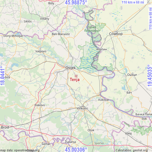
Tenja GPS coordinates[2]
45° 29' 53.016" North, 18° 44' 49.992" East
| Map corner | latitude | longitude |
|---|---|---|
| Upper-left | 45.98875°, | 18.0441° |
| Center: | 45.49806°, | 18.74722° |
| Lower-right: | 45.00306°, | 19.45035° |
| Map W x H: | 109.6×109.6 km | = 68.1×68.1mi |
| max Lat: | 46.52694° ⇑46.8% North |
| Tenja: | 45.49806° |
| min Lat: | ⇓53.2% South 42.54972° |
| min Long | Tenja | max Long |
| 13.52389° | 18.74722° | 19.37694° |
| W 95.1%⇐ | ⇒4.9% E |
Elevation
Elevation of Tenja is 89 m = 292 ft, and this is 64.3 m = 211 ft below average elevation for this country.
| Max E: |
827 m = 2713 ft | 74.8% |
| Avg. | 153.3 m = 503 ft | |
| Tenja | 89 m = 292 ft | |
Min E: |
-1 m = -3 ft | 25.2% |
See also: Croatia elevation on elevation.city.
Geographical zone
Tenja is located in North temperate zone (between Tropic of Cancer and the Arctic Circle). Distance of this North polar circle is 2342.3 km =1455.4 mi to North.| Distance of | km | miles | from Tenja |
|---|---|---|---|
| North Pole | 4948.2 | 3074.7 | to North |
| Arctic Circle | 2342.3 | 1455.4 | to North |
| Tropic Cancer | 2453 | 1524.2 | to South |
| Equator | 5058.9 | 3143.5 | to South |


Nearby cities:
15 places around Tenja: (largest is in red/bold)
• Antin
12.9 km =8 mi,  178°
178°
• Antunovac
5.7 km =3.5 mi,  261°
261°
• Bijelo Brdo
9.9 km =6.2 mi,  77°
77°
• Bilje
12.1 km =7.5 mi,  358°
358°
• Bobota
11.9 km =7.4 mi,  135°
135°
• Brijest
6.4 km =4 mi,  293°
293°
• Ernestinovo
8.6 km =5.3 mi,  233°
233°
• Kopačevo
11.9 km =7.4 mi,  14°
14°
• Laslovo
10.1 km =6.3 mi,  203°
203°
• Livana
11.9 km =7.4 mi, 286°
• Mece
13.6 km =8.5 mi,  351°
351°
• Osijek
7.2 km =4.5 mi,  324°
324°
• Sarvaš
7.7 km =4.8 mi,  65°
65°
• Tvrđavica
9.9 km =6.2 mi,  325°
325°
• Višnjevac
13 km =8.1 mi,  307°
307°
Sources, notices
• [Note1] Compared only with cities in Croatia existing in our database
• [Src1] Map data: © OpenStreetMap contributors (CC-BY-SA)
• [Src2] Other city data from geonames.org with taken over terms of usage.
• [Src3] Geographical zone / Annual Mean Temperature by Robert A. Rohde @ Wikipedia
