Ivanić-Grad geodata
Ivanić-Grad (Zagrebačka) is a seat of a second-order administrative division; located in Croatia in Europe/Zagreb (GMT+2) time zone. In our database, there are 904 cities with bigger population. Compared to other cities in Croatia, 65.8% of cities are located further ↓South; 53% of cities are located further →East and 64.4% of cities have higher elevation than Ivanić-Grad. Note1


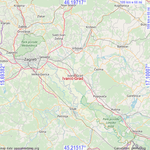
Ivanić-Grad GPS coordinates[2]
45° 42' 29.988" North, 16° 23' 48.984" East
| Map corner | latitude | longitude |
|---|---|---|
| Upper-left | 46.19717°, | 15.69382° |
| Center: | 45.70833°, | 16.39694° |
| Lower-right: | 45.21517°, | 17.10007° |
| Map W x H: | 109.2×109.2 km | = 67.9×67.9mi |
| max Lat: | 46.52694° ⇑34.2% North |
| Ivanić-Grad: | 45.70833° |
| min Lat: | ⇓65.8% South 42.54972° |
| min Long | Ivanić-Grad | max Long |
| 13.52389° | 16.39694° | 19.37694° |
| W 47%⇐ | ⇒53% E |
Elevation
Elevation of Ivanić-Grad is 103 m = 338 ft, and this is 50.3 m = 165 ft below average elevation for this country.
| Max E: |
827 m = 2713 ft | 64.4% |
| Avg. | 153.3 m = 503 ft | |
| Ivanić-Grad | 103 m = 338 ft | |
Min E: |
-1 m = -3 ft | 35.6% |
See also: Croatia elevation on elevation.city.
Geographical zone
Ivanić-Grad is located in North temperate zone (between Tropic of Cancer and the Arctic Circle). Distance of this North polar circle is 2318.9 km =1440.9 mi to North.| Distance of | km | miles | from Ivanić-Grad |
|---|---|---|---|
| North Pole | 4924.8 | 3060.1 | to North |
| Arctic Circle | 2318.9 | 1440.9 | to North |
| Tropic Cancer | 2476.4 | 1538.8 | to South |
| Equator | 5082.3 | 3158 | to South |


Nearby cities:
15 places around Ivanić-Grad: (largest is in red/bold)
• Bunjani
8.1 km =5 mi,  96°
96°
• Deanovec
6.8 km =4.2 mi, 102°
• Gornja Greda
12.9 km =8 mi,  333°
333°
• Kloštar Ivanić
4.2 km =2.6 mi,  30°
30°
• Križ
10.9 km =6.8 mi,  116°
116°
• Lupoglav
10.5 km =6.5 mi,  338°
338°
• Martinska Ves
14 km =8.7 mi,  186°
186°
• Novoselec
12.5 km =7.8 mi, 119°
• Oborovo
11.2 km =7 mi,  255°
255°
• Orle
13 km =8.1 mi, 257°
• Posavski Bregi
4.6 km =2.9 mi,  226°
226°
• Prikraj
14.5 km =9 mi, 333°
• Puhovo
14.6 km =9.1 mi,  309°
309°
• Rugvica
13.1 km =8.1 mi,  283°
283°
• Velika Ostrna
12.6 km =7.8 mi, 314°
Sources, notices
• [Note1] Compared only with cities in Croatia existing in our database
• [Src1] Map data: © OpenStreetMap contributors (CC-BY-SA)
• [Src2] Other city data from geonames.org with taken over terms of usage.
• [Src3] Geographical zone / Annual Mean Temperature by Robert A. Rohde @ Wikipedia
