Gornja Gračenica geodata
Gornja Gračenica (Sisačko-Moslavačka) is a populated place; located in Croatia in Europe/Zagreb (GMT+2) time zone. With population of 954 people, there are 485 cities with bigger population in this country. Compared to other cities in Croatia, 54.2% of cities are located further ↓South; 60% of cities are located further ←West and 58.3% of cities have higher elevation than Gornja Gračenica. Note1


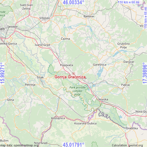
Gornja Gračenica GPS coordinates[2]
45° 30' 46.008" North, 16° 41' 44.988" East
| Map corner | latitude | longitude |
|---|---|---|
| Upper-left | 46.00334°, | 15.99271° |
| Center: | 45.51278°, | 16.69583° |
| Lower-right: | 45.01791°, | 17.39896° |
| Map W x H: | 109.6×109.6 km | = 68.1×68.1mi |
| max Lat: | 46.52694° ⇑45.8% North |
| Gornja Gračenica: | 45.51278° |
| min Lat: | ⇓54.2% South 42.54972° |
| min Long | Gornja Gračeni | max Long |
| 13.52389° | 16.69583° | 19.37694° |
| W 60%⇐ | ⇒40% E |
Elevation
Elevation of Gornja Gračenica is 112 m = 367 ft, and this is 41.3 m = 135 ft below average elevation for this country.
| Max E: |
827 m = 2713 ft | 58.3% |
| Avg. | 153.3 m = 503 ft | |
| Gornja Gračenica | 112 m = 367 ft | |
Min E: |
-1 m = -3 ft | 41.7% |
See also: Croatia elevation on elevation.city.
Geographical zone
Gornja Gračenica is located in North temperate zone (between Tropic of Cancer and the Arctic Circle). Distance of this North polar circle is 2340.6 km =1454.4 mi to North.| Distance of | km | miles | from Gornja Gračenica |
|---|---|---|---|
| North Pole | 4946.5 | 3073.6 | to North |
| Arctic Circle | 2340.6 | 1454.4 | to North |
| Tropic Cancer | 2454.6 | 1525.2 | to South |
| Equator | 5060.5 | 3144.4 | to South |


Nearby cities:
15 places around Gornja Gračenica: (largest is in red/bold)
• Donja Gračenica
2.4 km =1.5 mi,  212°
212°
• Gornja Jelenska
9.6 km =6 mi,  1°
1°
• Husain
10.1 km =6.3 mi,  115°
115°
• Ilova
15.4 km =9.6 mi, 116°
• Kapelica
16.9 km =10.5 mi,  65°
65°
• Kutina
7.9 km =4.9 mi, 122°
• Kutinska Slatina
6.8 km =4.2 mi,  86°
86°
• Osekovo
6.2 km =3.9 mi,  273°
273°
• Popovača
8.4 km =5.2 mi,  318°
318°
• Potok
9.1 km =5.7 mi,  296°
296°
• Repušnica
3.5 km =2.2 mi,  129°
129°
• Stružec
11.2 km =7 mi,  278°
278°
• Velika Ludina
12.2 km =7.6 mi, 322°
• Vidrenjak
14.4 km =8.9 mi, 319°
• Voloder
4.1 km =2.5 mi,  341°
341°
Sources, notices
• [Note1] Compared only with cities in Croatia existing in our database
• [Src1] Map data: © OpenStreetMap contributors (CC-BY-SA)
• [Src2] Other city data from geonames.org with taken over terms of usage.
• [Src3] Geographical zone / Annual Mean Temperature by Robert A. Rohde @ Wikipedia
