Gromačnik geodata
Gromačnik (Slavonski Brod-Posavina) is a populated place; located in Croatia in Europe/Zagreb (GMT+2) time zone. With population of 556 people, there are 803 cities with bigger population in this country. Compared to other cities in Croatia, 69% of cities are located further ↑North; 81.2% of cities are located further ←West and 59.9% of cities have higher elevation than Gromačnik. Note1


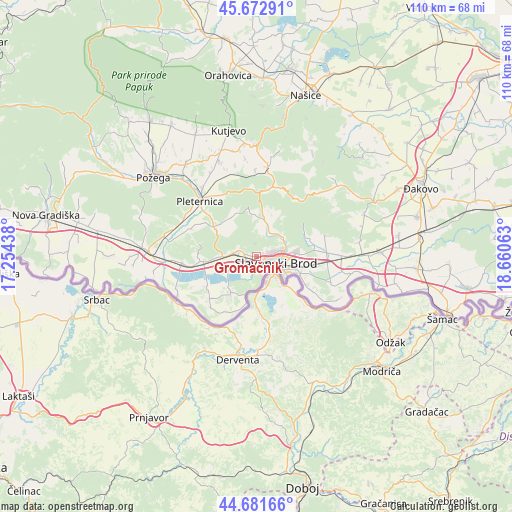
Gromačnik GPS coordinates[2]
45° 10' 45.984" North, 17° 57' 27" East
| Map corner | latitude | longitude |
|---|---|---|
| Upper-left | 45.67291°, | 17.25438° |
| Center: | 45.17944°, | 17.9575° |
| Lower-right: | 44.68166°, | 18.66063° |
| Map W x H: | 110.2×110.2 km | = 68.5×68.5mi |
| max Lat: | 46.52694° ⇑69% North |
| Gromačnik: | 45.17944° |
| min Lat: | ⇓31% South 42.54972° |
| min Long | Gromačnik | max Long |
| 13.52389° | 17.9575° | 19.37694° |
| W 81.2%⇐ | ⇒18.8% E |
Elevation
Elevation of Gromačnik is 109 m = 358 ft, and this is 44.3 m = 145 ft below average elevation for this country.
| Max E: |
827 m = 2713 ft | 59.9% |
| Avg. | 153.3 m = 503 ft | |
| Gromačnik | 109 m = 358 ft | |
Min E: |
-1 m = -3 ft | 40.1% |
See also: Croatia elevation on elevation.city.
Geographical zone
Gromačnik is located in North temperate zone (between Tropic of Cancer and the Arctic Circle). Distance of this North polar circle is 2377.7 km =1477.4 mi to North.| Distance of | km | miles | from Gromačnik |
|---|---|---|---|
| North Pole | 4983.6 | 3096.7 | to North |
| Arctic Circle | 2377.7 | 1477.4 | to North |
| Tropic Cancer | 2417.6 | 1502.2 | to South |
| Equator | 5023.5 | 3121.5 | to South |


Nearby cities:
15 places around Gromačnik: (largest is in red/bold)
• Bartolovci
2.1 km =1.3 mi,  280°
280°
• Brodski Stupnik
12.1 km =7.5 mi,  263°
263°
• Brodski Varoš
1.7 km =1.1 mi,  83°
83°
• Bukovlje
8.8 km =5.5 mi,  85°
85°
• Donja Vrba
11.8 km =7.3 mi,  97°
97°
• Gornja Vrba
8.9 km =5.5 mi,  107°
107°
• Kaniža
9.7 km =6 mi,  215°
215°
• Podcrkavlje
6.4 km =4 mi,  39°
39°
• Podvinje
5.6 km =3.5 mi, 77°
• Ruščica
10.2 km =6.3 mi, 110°
• Sibinj
4.1 km =2.5 mi,  289°
289°
• Slavonski Brod
5 km =3.1 mi,  115°
115°
• Slobodnica
2.7 km =1.7 mi,  225°
225°
• Vranovci
10.4 km =6.5 mi, 87°
• Šumeće
13.1 km =8.1 mi,  208°
208°
Sources, notices
• [Note1] Compared only with cities in Croatia existing in our database
• [Src1] Map data: © OpenStreetMap contributors (CC-BY-SA)
• [Src2] Other city data from geonames.org with taken over terms of usage.
• [Src3] Geographical zone / Annual Mean Temperature by Robert A. Rohde @ Wikipedia
