Podcrkavlje geodata
Podcrkavlje (Slavonski Brod-Posavina) is a seat of a second-order administrative division; located in Croatia in Europe/Zagreb (GMT+2) time zone. In our database, there are 904 cities with bigger population. Compared to other cities in Croatia, 65.4% of cities are located further ↑North; 81.8% of cities are located further ←West and 52.4% of cities have lower elevation than Podcrkavlje. Note1


Podcrkavlje GPS coordinates[2]
45° 13' 26.004" North, 18° 0' 36" East
| Map corner | latitude | longitude |
|---|---|---|
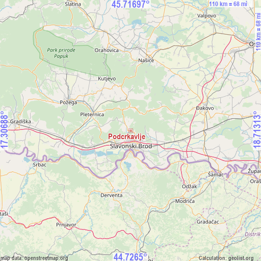
| Upper-left | 45.71697°, | 17.30688° |
| Center: | 45.22389°, | 18.01° |
| Lower-right: | 44.7265°, | 18.71313° |
| Map W x H: | 110.1×110.1 km | = 68.4×68.4mi |
| max Lat: | 46.52694° ⇑65.4% North |
| Podcrkavlje: | 45.22389° |
| min Lat: | ⇓34.6% South 42.54972° |
| min Long | Podcrkavlje | max Long |
| 13.52389° | 18.01° | 19.37694° |
| W 81.8%⇐ | ⇒18.2% E |
Elevation
Elevation of Podcrkavlje is 131 m = 430 ft, and this is 22.3 m = 73 ft below average elevation for this country.
| Max E: |
827 m = 2713 ft | 47.6% |
| Avg. | 153.3 m = 503 ft | |
| Podcrkavlje | 131 m = 430 ft | |
Min E: |
-1 m = -3 ft | 52.4% |
See also: Croatia elevation on elevation.city.
Geographical zone
Podcrkavlje is located in North temperate zone (between Tropic of Cancer and the Arctic Circle). Distance of this North polar circle is 2372.7 km =1474.3 mi to North.| Distance of | km | miles | from Podcrkavlje |
|---|---|---|---|
| North Pole | 4978.6 | 3093.6 | to North |
| Arctic Circle | 2372.7 | 1474.3 | to North |
| Tropic Cancer | 2422.5 | 1505.3 | to South |
| Equator | 5028.4 | 3124.5 | to South |


Nearby cities:
15 places around Podcrkavlje: (largest is in red/bold)
• Bartolovci
7.7 km =4.8 mi,  233°
233°
• Brodski Varoš
5.4 km =3.4 mi,  207°
207°
• Bukovlje
6.4 km =4 mi,  132°
132°
• Donja Vrba
10 km =6.2 mi, 130°
• Gornja Vrba
8.8 km =5.5 mi,  150°
150°
• Gromačnik
6.4 km =4 mi,  219°
219°
• Klokočevik
11 km =6.8 mi,  92°
92°
• Korenica
12.2 km =7.6 mi, 89°
• Podvinje
4 km =2.5 mi,  160°
160°
• Ruščica
10.2 km =6.3 mi, 147°
• Sibinj
8.8 km =5.5 mi,  245°
245°
• Slavonski Brod
7.1 km =4.4 mi,  176°
176°
• Slobodnica
9.1 km =5.7 mi, 221°
• Trnjani
11.1 km =6.9 mi,  111°
111°
• Vranovci
7.7 km =4.8 mi,  124°
124°
Sources, notices
• [Note1] Compared only with cities in Croatia existing in our database
• [Src1] Map data: © OpenStreetMap contributors (CC-BY-SA)
• [Src2] Other city data from geonames.org with taken over terms of usage.
• [Src3] Geographical zone / Annual Mean Temperature by Robert A. Rohde @ Wikipedia
