Brdovec geodata
Brdovec (Zagrebačka) is a seat of a second-order administrative division; located in Croatia in Europe/Zagreb (GMT+2) time zone. With population of 2,321 people, there are 180 cities with bigger population in this country. Compared to other cities in Croatia, 75.2% of cities are located further ↓South; 76.4% of cities are located further →East and 51.2% of cities have lower elevation than Brdovec. Note1


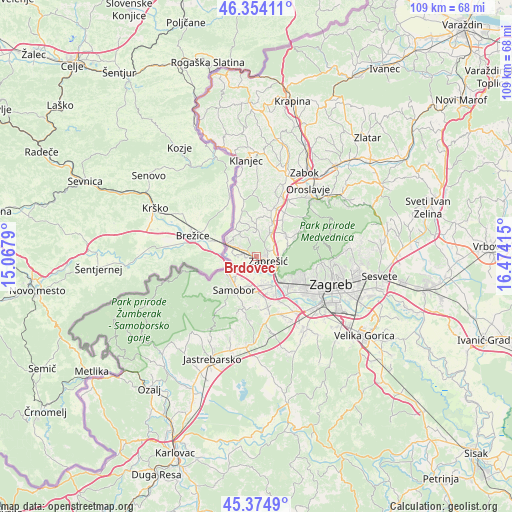
Brdovec GPS coordinates[2]
45° 51' 59.976" North, 15° 46' 15.672" East
| Map corner | latitude | longitude |
|---|---|---|
| Upper-left | 46.35411°, | 15.0679° |
| Center: | 45.86666°, | 15.77102° |
| Lower-right: | 45.3749°, | 16.47415° |
| Map W x H: | 108.9×108.9 km | = 67.7×67.7mi |
| max Lat: | 46.52694° ⇑24.8% North |
| Brdovec: | 45.86666° |
| min Lat: | ⇓75.2% South 42.54972° |
| min Long | Brdovec | max Long |
| 13.52389° | 15.77102° | 19.37694° |
| W 23.6%⇐ | ⇒76.4% E |
Elevation
Elevation of Brdovec is 129 m = 423 ft, and this is 24.3 m = 80 ft below average elevation for this country.
| Max E: |
827 m = 2713 ft | 48.8% |
| Avg. | 153.3 m = 503 ft | |
| Brdovec | 129 m = 423 ft | |
Min E: |
-1 m = -3 ft | 51.2% |
See also: Croatia elevation on elevation.city.
Geographical zone
Brdovec is located in North temperate zone (between Tropic of Cancer and the Arctic Circle). Distance of this North polar circle is 2301.3 km =1430 mi to North.| Distance of | km | miles | from Brdovec |
|---|---|---|---|
| North Pole | 4907.2 | 3049.2 | to North |
| Arctic Circle | 2301.3 | 1430 | to North |
| Tropic Cancer | 2494 | 1549.7 | to South |
| Equator | 5099.9 | 3168.9 | to South |


Nearby cities:
15 places around Brdovec: (largest is in red/bold)
• Domaslovec
6.6 km =4.1 mi,  192°
192°
• Donja Pušća
5.6 km =3.5 mi,  5°
5°
• Donji Laduč
3.5 km =2.2 mi,  302°
302°
• Gornja Pušća
6.9 km =4.3 mi,  0°
0°
• Gornji Laduč
4.9 km =3 mi,  293°
293°
• Ivanec Bistranski
5.2 km =3.2 mi,  115°
115°
• Jablanovec
6.5 km =4 mi,  80°
80°
• Javorje
0.9 km =0.6 mi,  215°
215°
• Ključ Brdovečki
6.3 km =3.9 mi, 286°
• Marija Gorica
6 km =3.7 mi,  325°
325°
• Orešje
6.1 km =3.8 mi,  156°
156°
• Pojatno
4.8 km =3 mi,  28°
28°
• Prigorje Brdovečko
2.9 km =1.8 mi, 299°
• Zaprešić
3.1 km =1.9 mi,  111°
111°
• Zdenci Brdovečki
1.6 km =1 mi,  270°
270°
Sources, notices
• [Note1] Compared only with cities in Croatia existing in our database
• [Src1] Map data: © OpenStreetMap contributors (CC-BY-SA)
• [Src2] Other city data from geonames.org with taken over terms of usage.
• [Src3] Geographical zone / Annual Mean Temperature by Robert A. Rohde @ Wikipedia
